Year: 2020
-

Record breaking Alaska storm spins rain our way. Happy New Year Thank you!
It’s beautiful if you’re not in it. That huge swirl in the top left corner might be the strongest Alaska storm ever recorded if it gets to 92kPa. It is just barely on the UWash map in the top corner, notice the lowest pressure is marked at 930hPa/93.0kPa on the bottom. Look at how tight…
-

Chance of snow Wednesday. Windy. Rain later. Don’t forget your people power!
Just a short post to confirm the possibility of snow and to remind you that if you have to shovel your walk, get out here early and often! It is going to be wet and heavy! The good news is, if we get enough you can always ask the Mayor to close a street for…
-

Possible flurries but mostly West Coast Christmas. Christmas Lights Map Updated! Merry Christmas!
System hits the Island early Christmas Morning As you can see above the rain will sweep over the Island in the 1-4AM period and most regions should see precipitation before 7AM. We could see Snow, briefly, for Christmas. If we retain some low level cold air, especially in the Valleys, this may start as showers,…
-

Clear skies coming – Great Conjuction of Jupiter and Saturn – Cold until Christmas
Crazy Monday morning It was quite the morning of weather as we had another intense rain event followed by snow around 9AM in Port Alberni. There was a bunch more on the eastern side of the Island and on the mountains. Some folks might just get up to that 20cm before it is finished this…
-

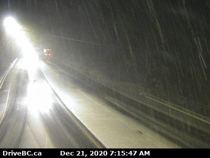
Update 9:00AM Monday – Snowfall Warning issued – Rain changing to Snow.
Update 9:00AM Rain changing to snow. Multiple reports across the Island that rain has changed to snow and we have now changed to sleet here in Port Alberni. If you are on the road, please drive carefully. We can expect this to last until mid-to-late morning on the central Island. Precipitation should end from north…
