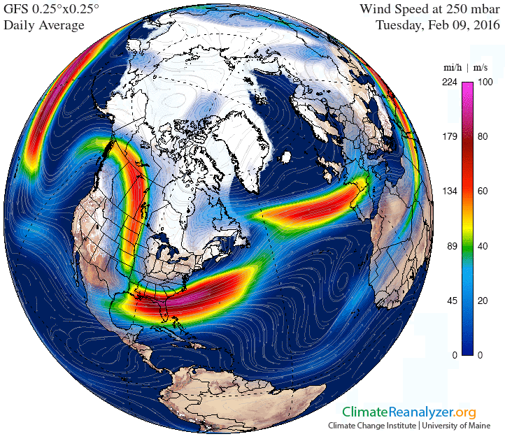
We got up over 12°C yesterday which was near a record. If the Airport hits the forecast high of 15°C today we will break the station record for the day. It may be a little warmer in town.
It will all depend on the fog moving out nice and early so we get lots of sun time.
We can thank the jetstream for the extreme warmth as it rides high to the north of us.
It is then diving deep into the south, which is going to pump frigid air into eastern North America.
It will slip overtop of us and bring rain starting tomorrow. Here it is on Thursday.
The rain will start first on Wednesday afternoon and evening but should not last too long into the night.
Thursday is going to be the big event of the week. Major rain will begin around Noon on Thursday, it may be accompanied with some wind.
We should easily get into the 50-60 mm range for the 4AM to 4AM Thursday/Friday period.
That’s it for now! Enjoy the sun on this Monday Tuesday 🙂


