The only pre-Christmas window for Philippine to get to San Francisco is today
Here’s the Youtube Version of this Forecast
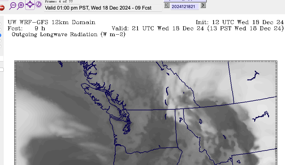
We should clear up today, Wednesday December 18. We might hear the familiar rumble of Philippine Mars returning home for some repairs… not necessarily because the repairs are so bad, but maybe more likely because today is the last clear flying day until probably at least Boxing Day and I’m sure the crews want to be home with their families for Christmas.
It looks clear on the forecast and clearing on Satellite too.
The satellite picture below confirms as well, just some light clouds over the Island. Clear to the West in the Pacific. But that is also where our future wet Christmas lurks…
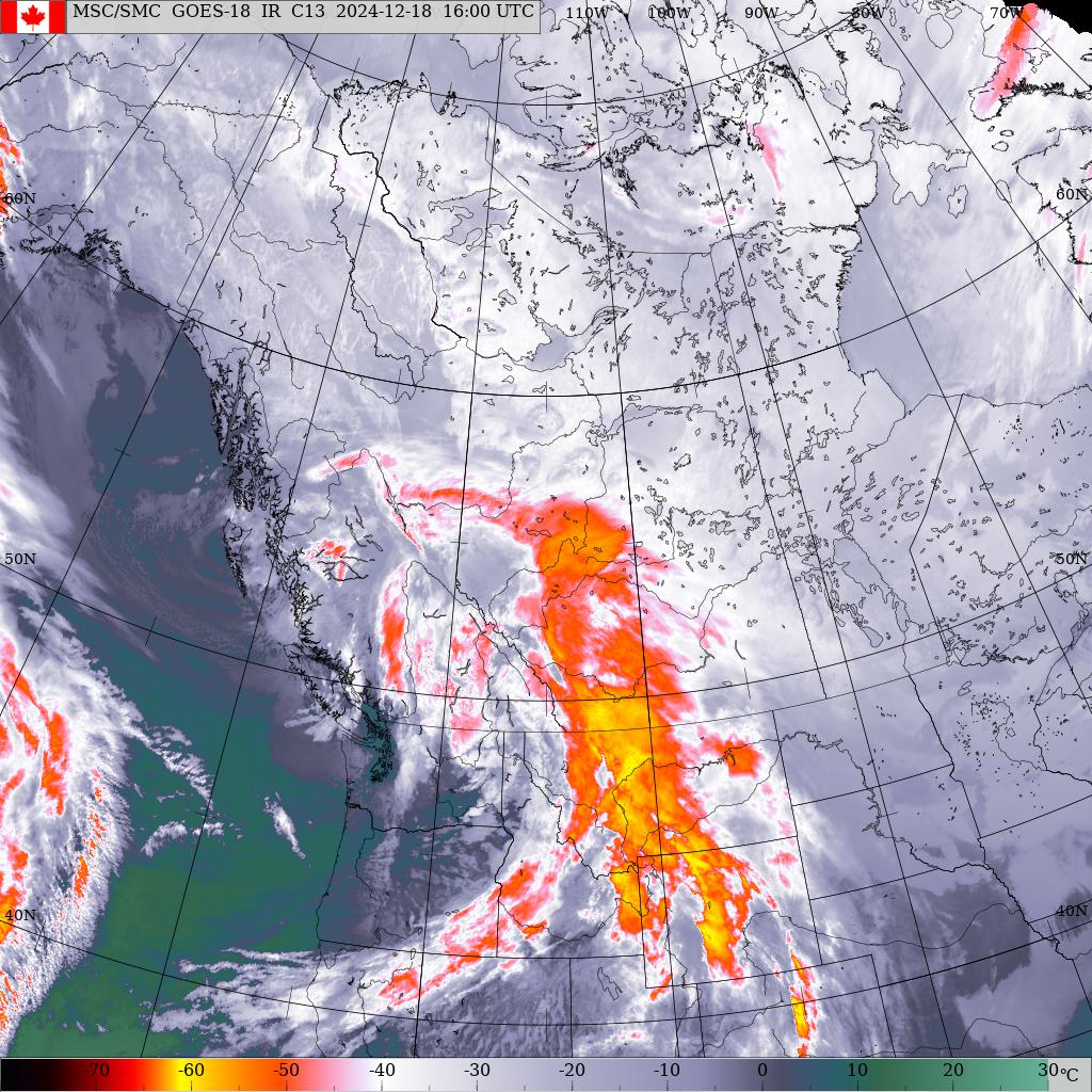
If the Philippine Mars crews can get her flight ready this morning, today will probably be the only “window” for the next week to fly down to San Francisco with clear skies.
Christmas Forecast – Rain, and then some more.
We are into a ‘rain train’ of systems for the next week through Christmas with the strongest rain storms looking to be in the Sunday to Tuesday timeframe. Here’s the timeline:
Thursday Morning
The first new system will begin Thursday Morning. By 7AM rain should have spread throughout the Island.
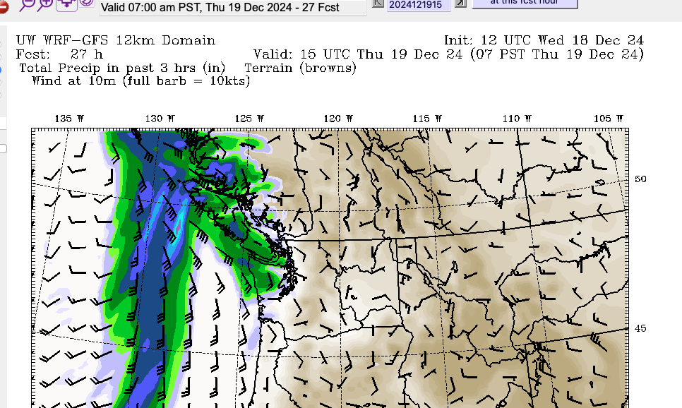
Expect this to last through the entire day on Thursday. It will clear overnight in preparation for weaker systems on Friday and Saturday.
Friday afternoon rain begins with Winter Solstice overnight
We should get a small break on Friday morning but by the afternoon the clouds should thicken again and rain should begin before sundown. By the way, the Solstice officially occurs at 1:20AM Saturday and Saturday is the shortest day, but Friday, Saturday and Sundar are all within 5 seconds of being the shortest day (9h 26m 33/31/34seconds).
Saturday – First Day of Winter – Wind early – Rain Late
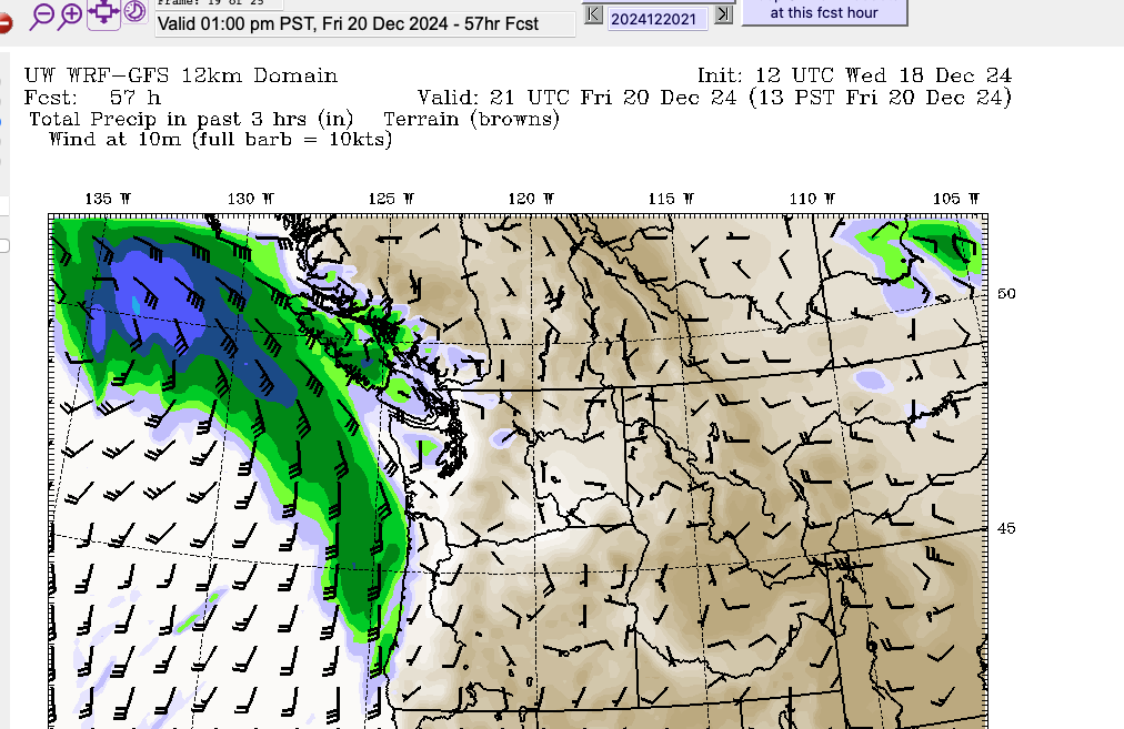
The first day of Winter is looking very West Coast. The forecast picture below shows light winds over the Island to start the morning but a small storm brewing offshore.
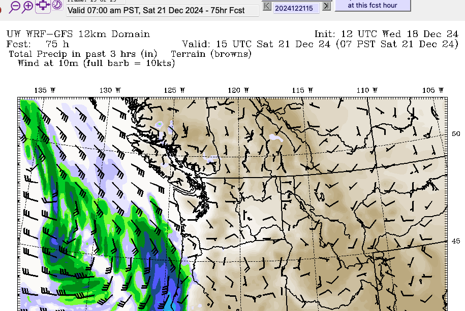
It looks like this will be a relatively weak storm in terms of rain, but it might give us some blustery wind conditions in the afternoon on Saturday with a low pressure centre moving over the Island in the afternoon and evening.
Sunday – First Storm of Concern
This is starting to reach out to the end of the forecast, but it’s usually pretty good at this stuff. So I take it seriously. This system looks like a potential problem on Sunday. It will at least deliver rain (and snow in the Interior) on a busy travel day. But it also looks like a strong wind event.
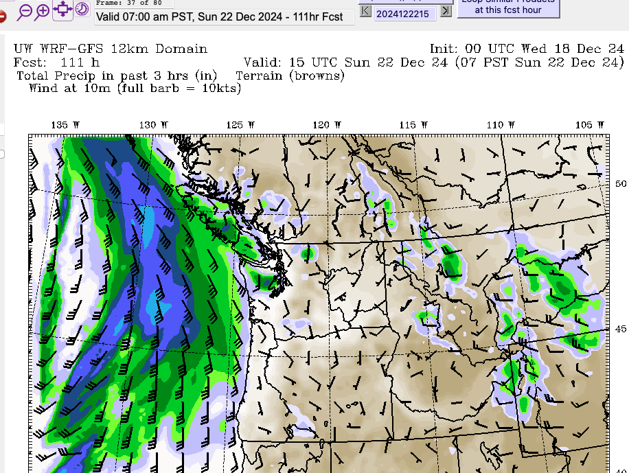
It should start by midday Sunday and last through the afternoon.
Stronger Storm Monday Dec 23 into Dec 24 Christmas Eve
Of even more concern, mostly because we’re getting toward Christmas and people will be travelling, is Monday night.
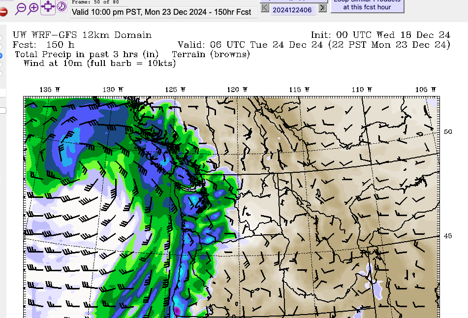
The rain doesn’t looks too bad, but this is definitely a potential wind event with winds on the coast up to 90kph.
This system will start impacting the coast on Monday night and go into Christmas Eve Day with strong South and Southwest winds along with rain lasting through Tuesday/Christmas Eve Day
Christmas Day
We might be cleaning up after the previous two storms on Christmas morning, but my hope with the forecast right now is that we get a break Christmas Morning before the next system comes in.
This is the end of the forecast range so it could certainly change, but as it stands, it’s a very wet and windy Christmas Day starting mid-morning.
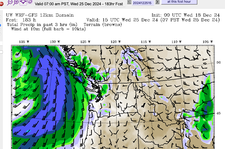
So that is your very green, quite wet, and possibly windy and storm Christmas forecast!
My Christmas Lights hate the rain… so I’m a little sad about that. But otherwise, I hope everyone out there is able to hunker down with some warm hot chocolate and friends and family over the next week as we ride out our West Coast Winter.
See you probably in a few days as I update the outlook closer to Christmas.

Leave a Reply
You must be logged in to post a comment.