Thankfully so far our rain/snow mix predicted for Wednesday has just been rain. It’s doing a nice job of cleaning the grime off the roads. The threat of it turning to snow would increase if it rained harder and caused the air to cool more, but at this point it looks like light rain in most areas.
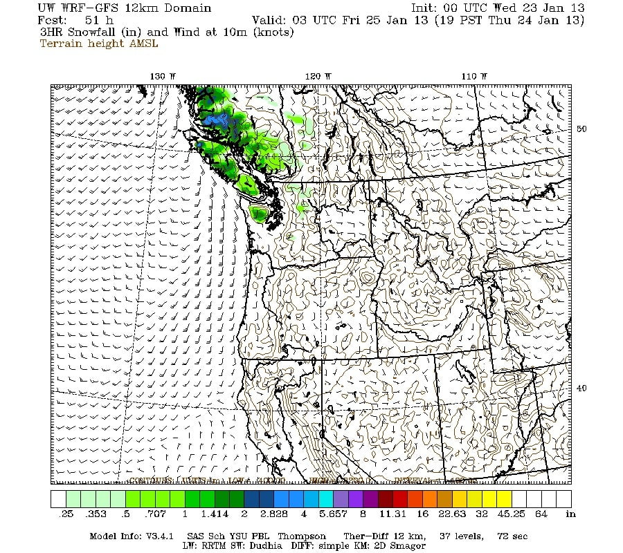
The next threat of snow is going to come Thursday night. Again, it will not be a sure thing and will most likely be rain, but with temperatures seeming like they are permanently stuck below 3C… Anything can happen.
Here is the snow cover image for Thursday night.
In the long range, there is a low that will come down from the North and go by just to the west of The Island. This can often cause East coast snow if the low turns inland over Northwest Washington State so that will be worth looking out for. EC does mention snow for Sunday for us but those patterns don’t usually give us much if anything as the Beaufort protect us from the Sea/Strait effect snow bands.

