A short update.
Now that’s rain:
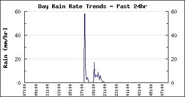
Yesterday we got caught in another thunderstorm, the third in the past few weeks. And this time it came with impressive rainfall. We received at Alberniweather 12mm of rain.. Which isnt much. But, we got it in a hurry. As the graph below shows. The rain rate hit 59mm/hr.
This is likely similar to the rainfall they had in Parksville a couple weeks back that caused all the flooding, in that case though, it was either just a little stronger or lasted a little longer.
To really put it into perspective though compare it to the Colorado rains that just ended. Read this excellent work comparing Colorado and Alberta.
On September 12th alone, Boulder received 230mm of rain and some areas got over 250mm in only six hours! So imagine yesterday’s downpour lasting for six hours, or a whole day. Imagine the havoc that would cause. Could it happen here? The last time we had major flooding, in 2006, we got I believe around 80mm in a 12 hour period. So roughly 1/3 what the event in Colorado produced. We don’t have the strong influence of the tropics or the extreme height of the Rockies to provide, and squeeze out, all that moisture. But if a similar low pressure area stalled over us and sent us wave after wave of moisture for a week or more, we likely wouldn’t be having any fun, especially if it happened in springtime with the freshet.
There is a presentation at Char’s Landing (the old church across from City Hall) by Keith Hunter of First Nations Wildcrafters. He’ll be talking about forests, it’s ancient and modern uses in our area, current practices, and maybe a bit about how current practices combine with changing weather patterns to change what we experience. Check it out, it starts at 7PM.
Wet Friday
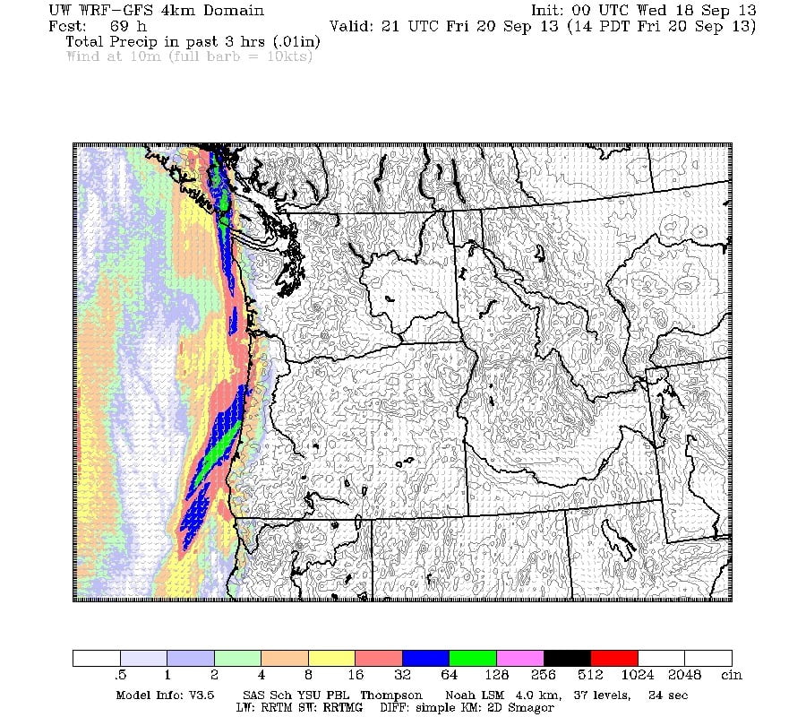
Next major weather for us will be Friday when what looks like a small, but strong, vigorous front moves across the Island.
The green is rainfall accumulation of 25mm, over 3 hours.

It will get to us by late morning Friday. It might be a little windy on Thursday before the front gets here too.

