Updated 9PM Wed: It may not stop raining.
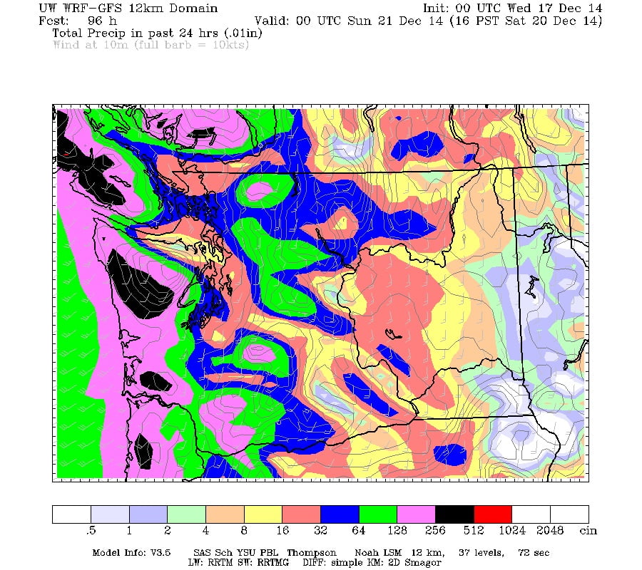
Seriously, check it out yourself… The latest UW model indicates less than 1 or 2 one hour periods between Thursday at 11AM and Sunday at 4AM where rain will not accumulate.
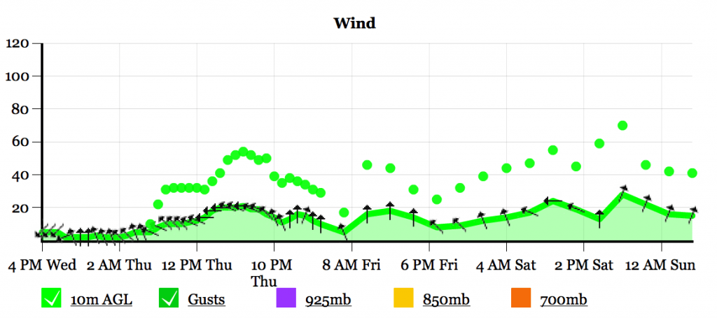
The GFS model over at Spotx is a little more kind, but still predicts 100mm between now and Sunday, plus some gusty winds on Thursday and Saturday evenings.


I’ll have another update Friday… but ya, hope you haven’t put away the sou’wester!
However… UWash has backed off a bit on its total rainfall. Still predicting 30mm between 4PM Thurs/Friday but “only” another 30 Fri/Sat. We’ll see what we get.
The rain continues.
It will rain most of the day on Wednesday and finally let up around 6PM tonight.
We should get through most of Thursday dry but by sundown it will begin to rain again, and rain quite hard most of Thursday night.
Totals between 4PM Thursday and Friday:

32 mm is expected. I will update this if the estimates change drastically.
We should get a few breaks on Friday but come Saturday and Sunday we can expect even more rain to fall right through the weekend.
Saturday a Concern:

The hills and rivers haven’t had a ton of time to dry out from the historic storms of last week, so there should be some concern with the strength of the storm coming on Saturday. It will linger through Sunday but not with large accumulations.
Again I will update this post if the forecast changes substantially. And I will have another post on Friday to nail things down.
Thankfully, we should dry right out on Monday and then have a short and less intense rain on Tuesday before Christmas. It is not looking good for snow on Christmas. I’d recommend heading up the mountains if you are in need of white. 🙂

