Update 10AM:
https://twitter.com/alberniweather/status/717031751839653888
There is a chance for some blustery and cool and showery weather Monday and Tuesday. The models look very patchy hough so it may be a case of localized heavier pockets of rain today and even more Tuesday.

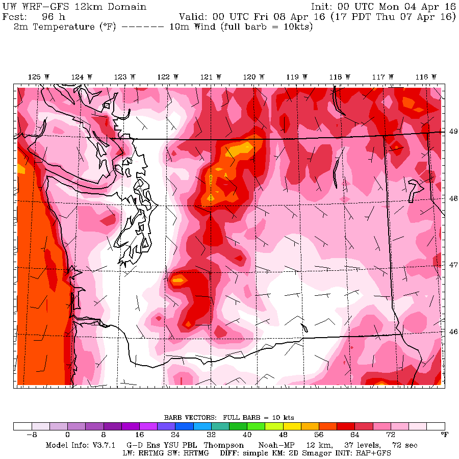
However, after that clears out we may very well be in for a scorching end to the work week.
Last nights long range, low resolution UWash model has temperatures hitting 30°C in the Lower Mainland. (In white)

Temperatures are into the high 20s in our area though today when this mornings model is the first to include Thursday in the short range high res forecast we should see whether we mimic the lower mainland or not. Either way, it is going to be very warm.
Happy Monday!

