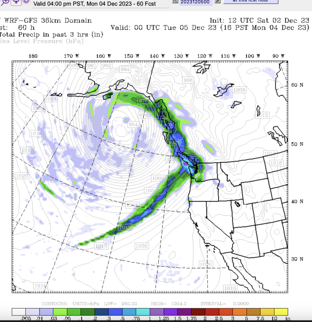
Pineapple Express On the Way
It’s on the horizon. The picture below is the forecast for Monday 1-4PM. As you can see, the tail of the moisture reaches far to the southwest. Hawaii is in the bottom-left corner. I real Pineapple Express!

Timing: Two Hits – Small Sunday Morning – Big Monday/Tuesday
We’ll see this storm in two waves. The first one will start before sunrise on Sunday. You can see the moisture reaching the Island in this 1AM-4AM picture.

The rain should stop for most areas before Noon as we can see below:

We may even see some clearing skies by Sunday afternoon.
Now let’s look at totals:


Judging by the 24 hour map above, from 4AM Sunday to 4AM Monday, Port Alberni, and most areas of the Island, are expected to get around 5-10mm. That’s not bad.
Big Rain Monday
The storm after the weekend is a little more serious. There is talk of it being a small Atmospheric River. Here’s the 24 hour total between 4AM Monday and Tuesday. Port Alberni is in the light red to dark red area, up to 50-65mm. (double that on the West Coast) The southern exposed mountain faces will get into the 200+mm range.


50mm isn’t too unusual for us. There may be some flooding. This system should be *just* warm enough not to put too much snow on the mountains, so while Mt. Washington will be disappointed, it will also mean more runoff into the local rivers from snow that is there and rain on top. Beware of fast flows and look out for advisories from the River Forecast Centre. There is a High Streamflow Advisory in Effect for the entire South Coast.
Rain should begin in the 7AM-10AM period on Sunday morning mostly focused on the North Island but it will be raining on the South Island too.

The rain will pick up strength, and the moisture will be pointed directly at us by evening Sunday. Below is the 4-7PM picture which should be the peak intensity.

The rain should start to taper off a little after Monday midnight but won’t really be finished until around 4AM on Tuesday.

October Timelapse up, November Summary and Timelapse coming.
The webcam has settled in nicely and today I got the October timelapse onto Youtube. (It’s way too big to download here :)). You can check it out below and follow @Alberniweather for more updates on the storm. Batten down the hatches!

