Wind starts late tonight – Possible Ferry Cancellations late Friday, early Saturday
Here’s the podcast for this forecast:
The good news is that for anyone travelling on a ferry, the winds are not supposed to reach the Island until late tonight, after 11PM judging by the forecast models here.
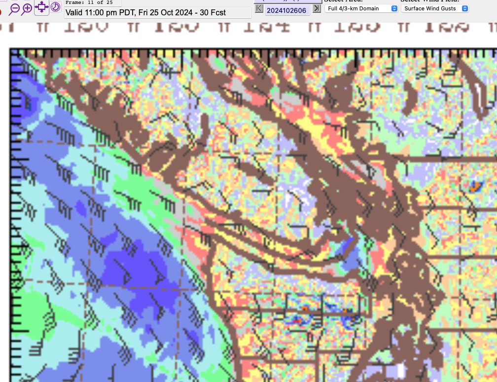
It will be gusty earlier on Friday on the West Coast, but the model is pretty solid on strong winds not reaching the Inland and East Coast of Vancouver Island until this 8-11PM picture. The blue areas are 40knots offshore and down in Victoria.
There is a possibility of power outages with this wind, and because it is SouthEasterly, I would expect Port Alberni to get at least some gusts though not to warning level. EC is forecasting 40-60kph for Inland Vancouver Island which is plenty. Up to 80kph on West and East Island.
In the next period shown below, 11PM-2AM you can see the wind quickly move across the Island and concentrate on the Strait of Georgia, particularly up in Courtenay.
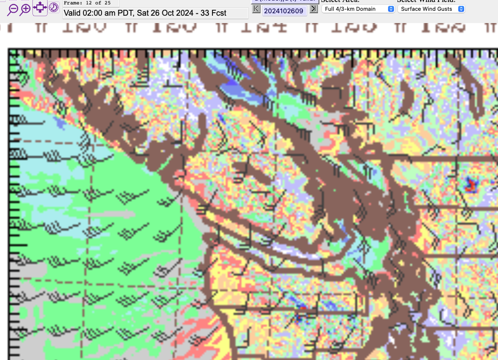
If there are going to be ferry cancellations, I would expect them for the first sailings Saturday morning.
You can see the wind starting to shift from SE to SW or Westerly and they should start to back off by sunrise.
Rain coming with the wind and then lingering Saturday and Sunday
A push of rain will accompany the strong winds tonight it will be strongest in the 11PM-2AM period shown below.
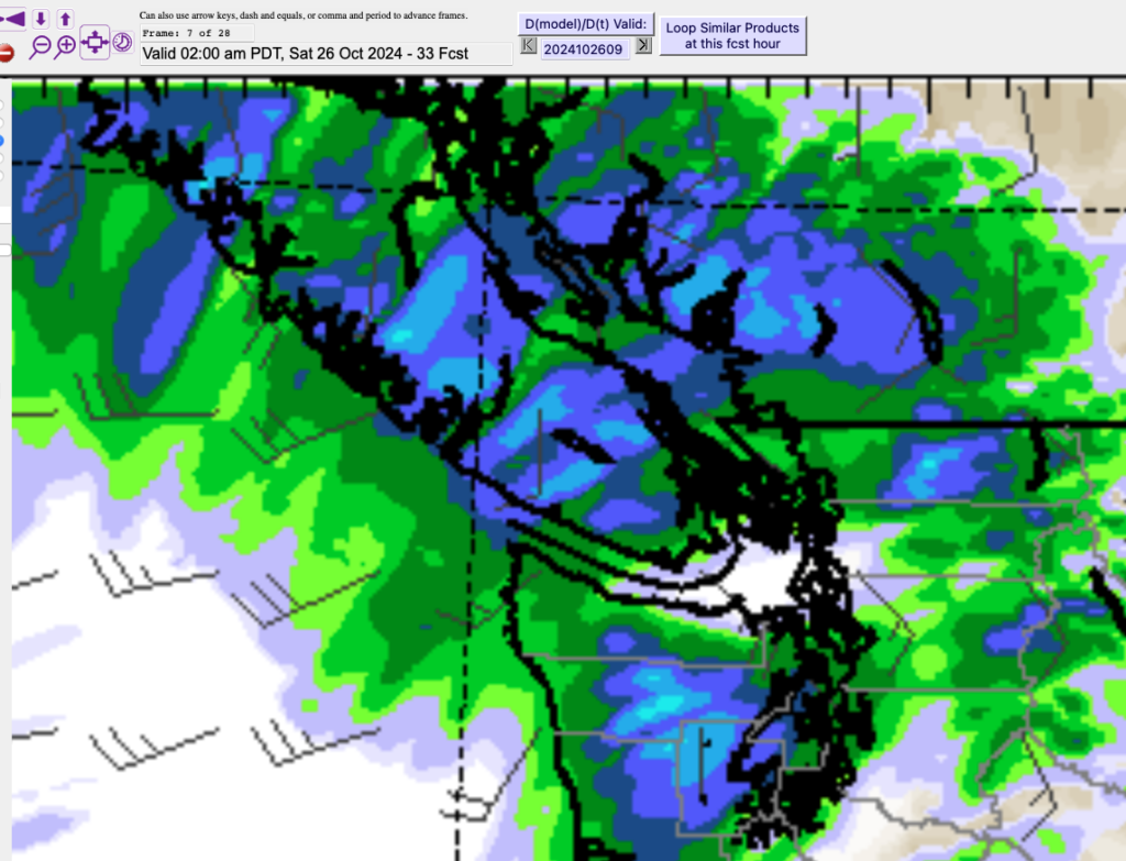
As the wind shifts to the SW and West in the morning, the rain should taper off. Accumulations should not be large.
However, after a short break Saturday morning, showers should pick up again in Port Alberni and pockets across the Island.
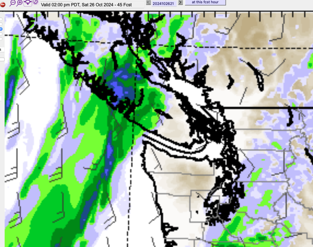
The winds might pick up again from the South and SouthEast along with this band of rain showers but from this point on the rain will be the bigger story. It won’t be an Atmospheric River situation but expect rain or showers throughout the afternoon and intensifying Saturday night.
Rain accumulations
The 24hrs from 5AM Saturday to 5AM Sunday look like the strongest period for the weekend focused on the West Coast and Alberni Valley with totals up to 50-75mm on the West Coast and 20-25 in Port Alberni.
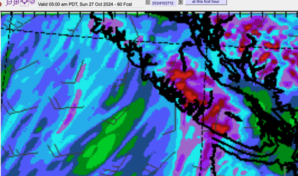

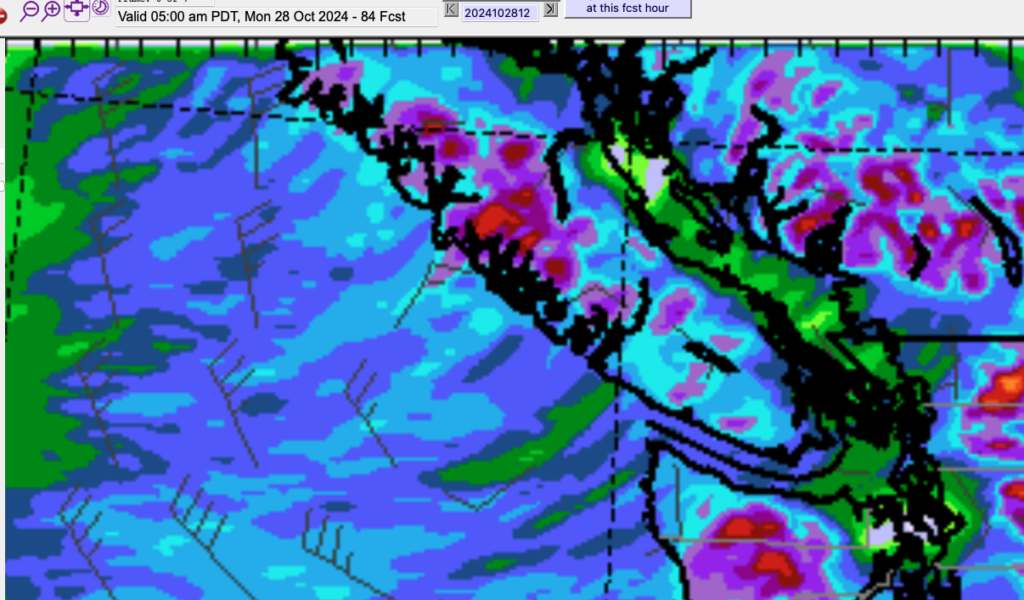
The following 24hrs has most of the rain onto the Northern sections of Vancouver Island. Certainly this bout of rain is nothing like last weekend.
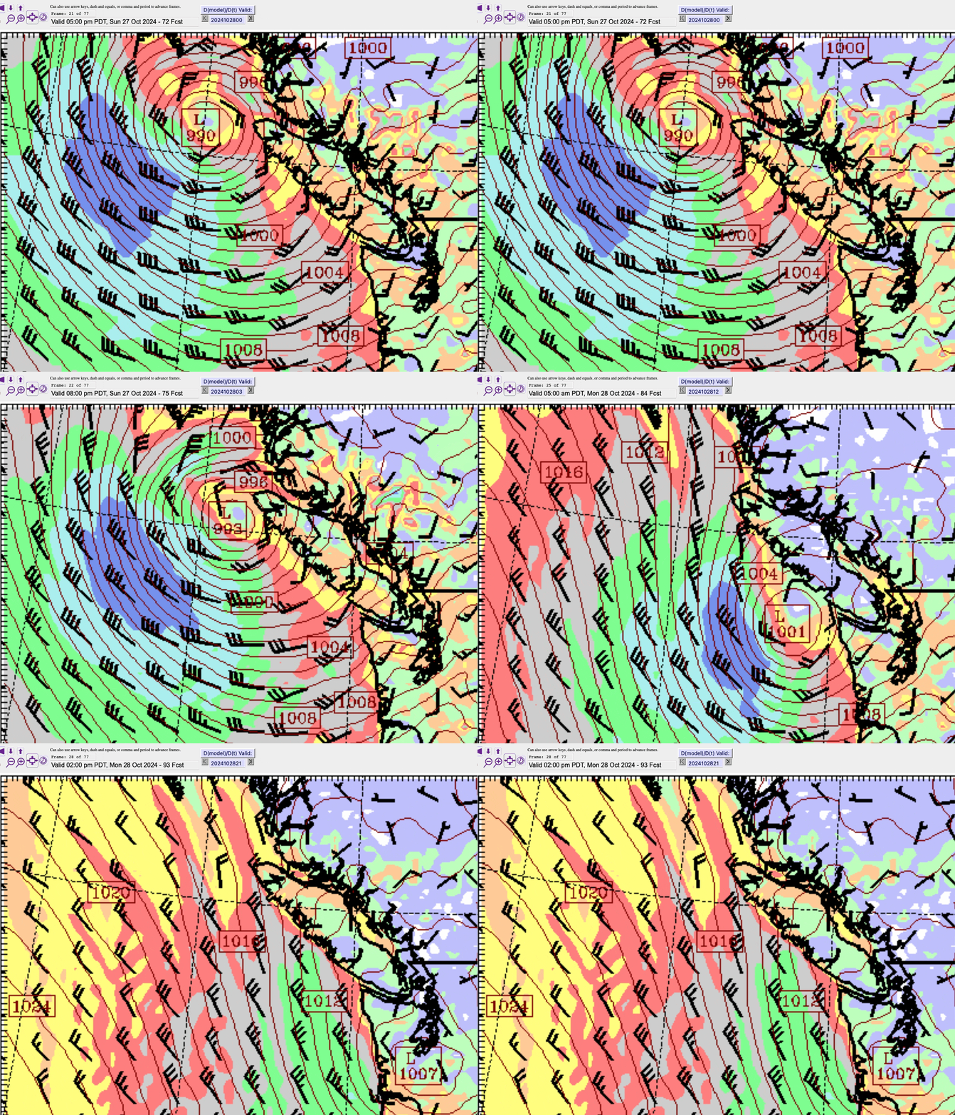
An Interesting low brushes past.
To end the weekend, we have an interesting low pressure system that moves down the West Coast of Vancouver Island from north to south. This is somewhat unusual. The lows usually move up from the SouthWest or West and into the BC Coast.
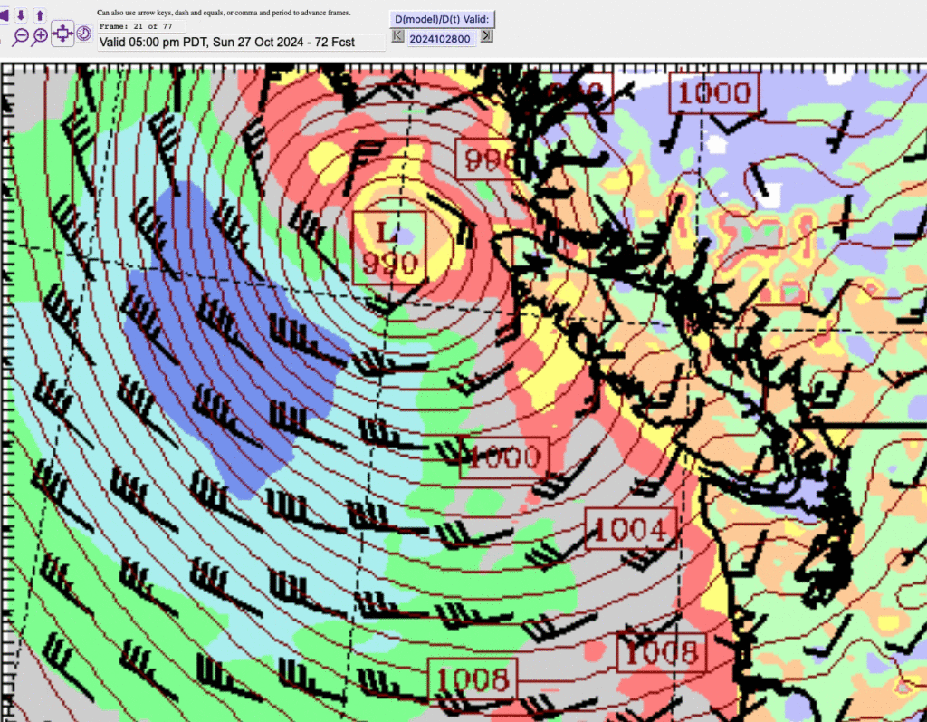
This kind of pattern is what you might see in the winter time that might bring strait-effect snow to the East side of the Island. Luckily, while this will bring in a little colder air, we’re not cold enough for snow this week, but perhaps it’s a harbinger of things to come? It has some strong northwest winds on the back of the low way offshore but it might also drag down some cold air into the Interior for next week.
Maybe some freezing temperatures for Halloween?
Have a great weekend!

