Thank you for visiting!
There were nearly 500 unique visitors to Alberniweather on November 19. And I know there were many that will have seen the Youtube channel, the Mastodon feed and other information. Thank you Port Alberni! I always do my best to bring relevant, accurate, and timely information.

Why was the City protected from the worst winds? Mt. Arrowsmith
In the Youtube below you can see more information about why and where the strongest winds affect the Alberni Valley. I also have the forecast at the end of the video. And please like and subscribe to the Channel!
I believe the short answer to the question is: the 1800m height of Mt. Arrowsmith.
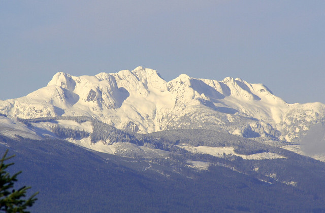
The strongest winds and damage reported in Port Alberni were in Cherry Creek past Cowley Road and Best Road, and around Drinkwater Road in Beaver Creek.
I think the topography is directly responsible. If you look at the map below you’ll see that the northern portions of Cherry Creek and Beaver Creek actually line up to be directly East of Cameron Lake and Cathedral Grove on the north edge of Mt. Arrowsmith. The pass there is a little lower than the mountain, allowing the winds access to the Alberni Valley.
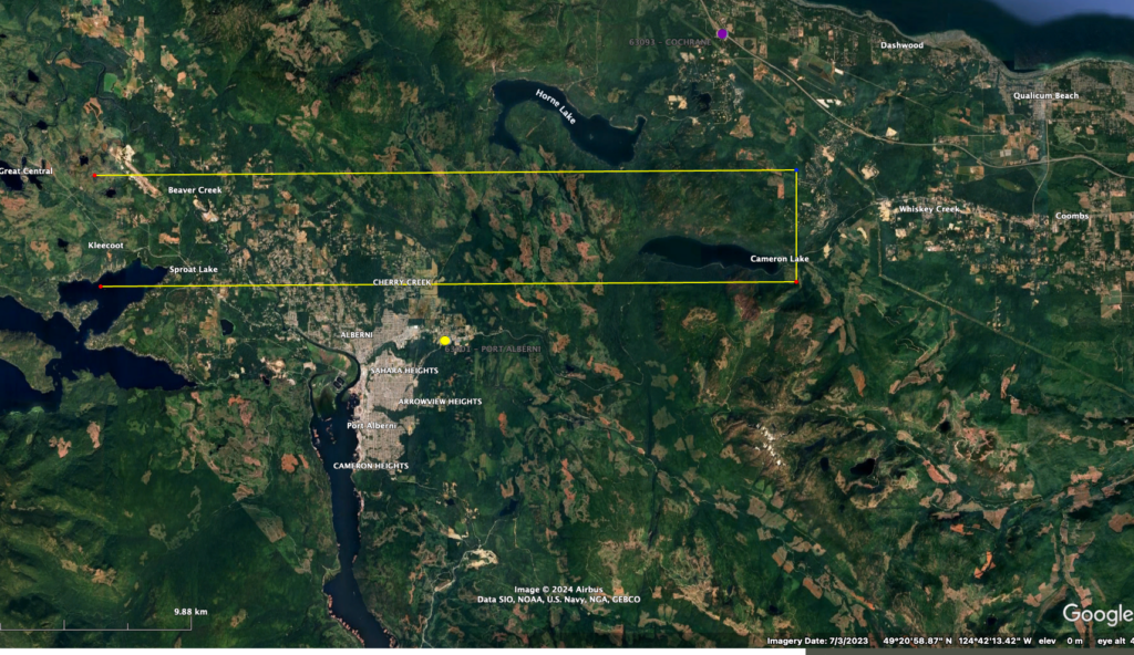
The winds on the 19th were unusual because they were from the East, or even ENE direction. I have been told by meteorologists that this unusual direction was a direct result of the size and strength of the bomb cyclone while still being so far off shore. As you can see, the E or ENE direction lines up very well with that gap. Here is a Youtube I made of the winds at the time on Cameron Lake on the 19th.
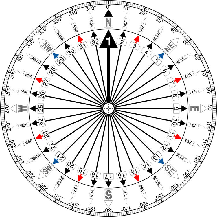
Here is the Alberni Airport data for the 19th. I’ve highlighted the winds in the 5PM hour. The Wind direction is in 10s of degrees, so 9 = 90º, 10 = 100º etc. East would be 90º. You can see the wind from the storm started in the 2PM hour from 80º (ENE) and gradually shifted to the East remained strongest from 100º known also as “East by South” meaning ‘Just south of East’. This was perfect to funnel through that gap and hit Cherry Creek, Beaver Creek, and to a lesser extent Sproat Lake. But leave the City of Port Alberni mostly protected.
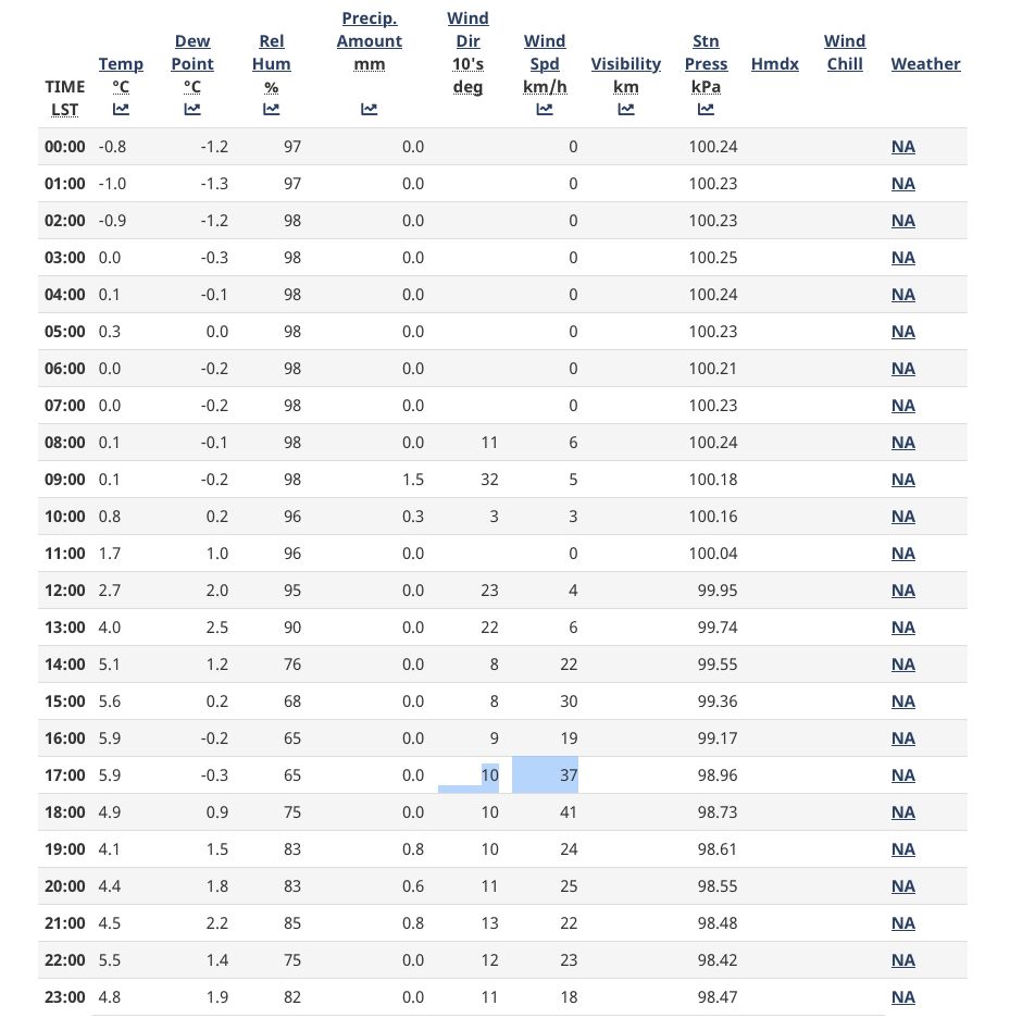
Only the strongest winds made it ‘around’ or over Mt. Arrowsmith to touch Port Alberni. Those strongest winds were around 7:45PM when Alberniweather measured 66kph direction from 90º, East.
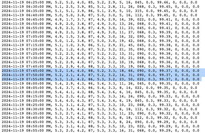
The Maximum Gust officially measured at the Alberni Airport may have been the strongest wind ever measured officially at that station: 78kph from 110º (ESE). I will be double checking this in the coming days.

Traditionally, Port Alberni sees its strongest winds from the SE (130-160º) because that lines up with the south end of Mount Arrowsmith as you can see below. So this 80º to 110º direction of wind was very unusual.
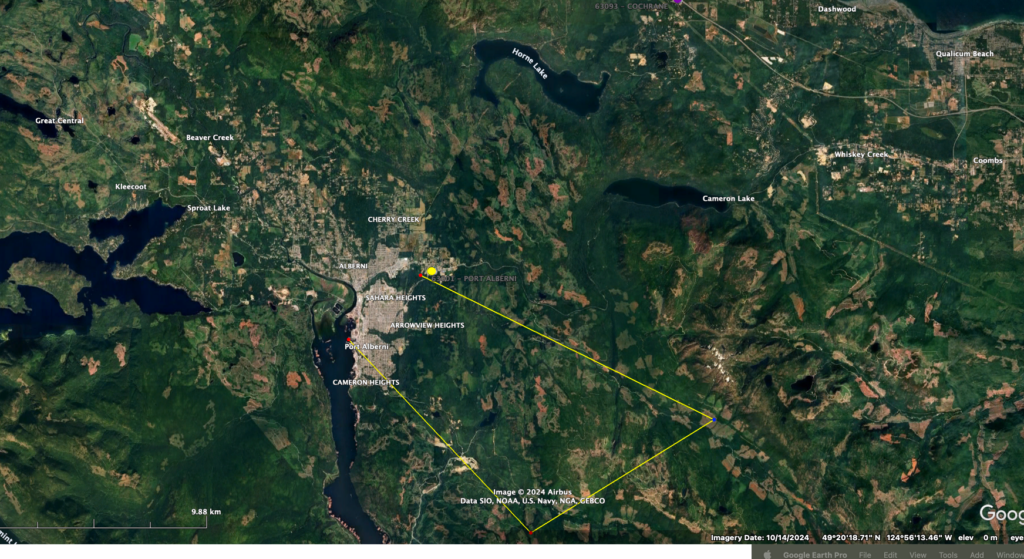
The 110º gust of 78kph at the Airport may have come around the south side of Mt. Arrowsmith. As you can see below, the southern edge of the mountain is bearing about 118º. (SEbE)
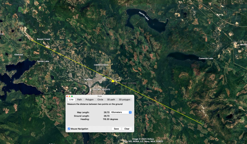
What we can be absolutely sure of is that the Mountain protected the vast majority of people in Port Alberni from the strongest winds.
Friday night winds.
We’re in for another system. This one a more traditional Southerly gale! Expect blustery winds on Friday evening and night (about the same timing as Tuesday)
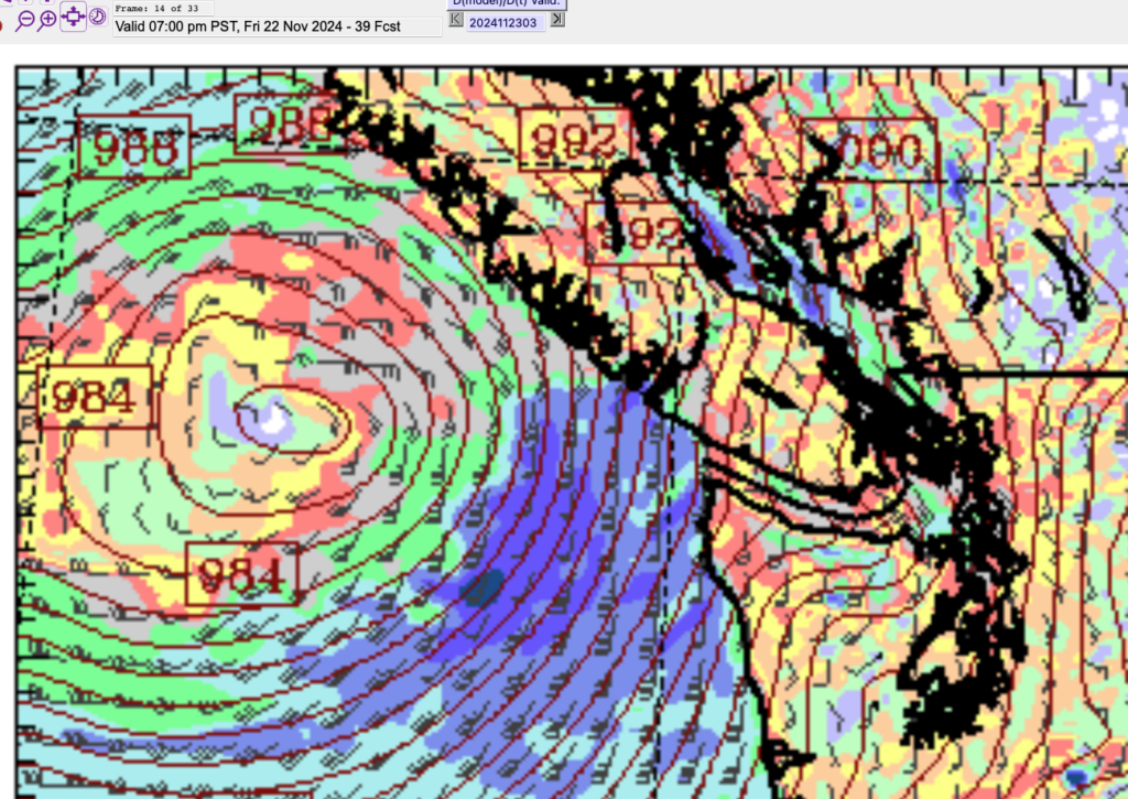
More Rain
We’ve also had a lot of rain in the past few days! 20mm in the past 24hrs and more going back to Tuesday. We will have rain starting on Friday night and lasting until Sunday afternoon.
Take care out there and be careful around any branches, downed trees or power lines.

