Short update today! It’s going to be a pleasant and warm weekend! 25C today. 23C tomorrow. Cool in the morning though.
The fire danger remains high or extreme though so please keep the fires down and be careful. The bush is tinder dry. The good news is there have been very few human caused fires. There have been more caused by Lightning in the region than humans, that’s quite unusual. So yay us.
………………
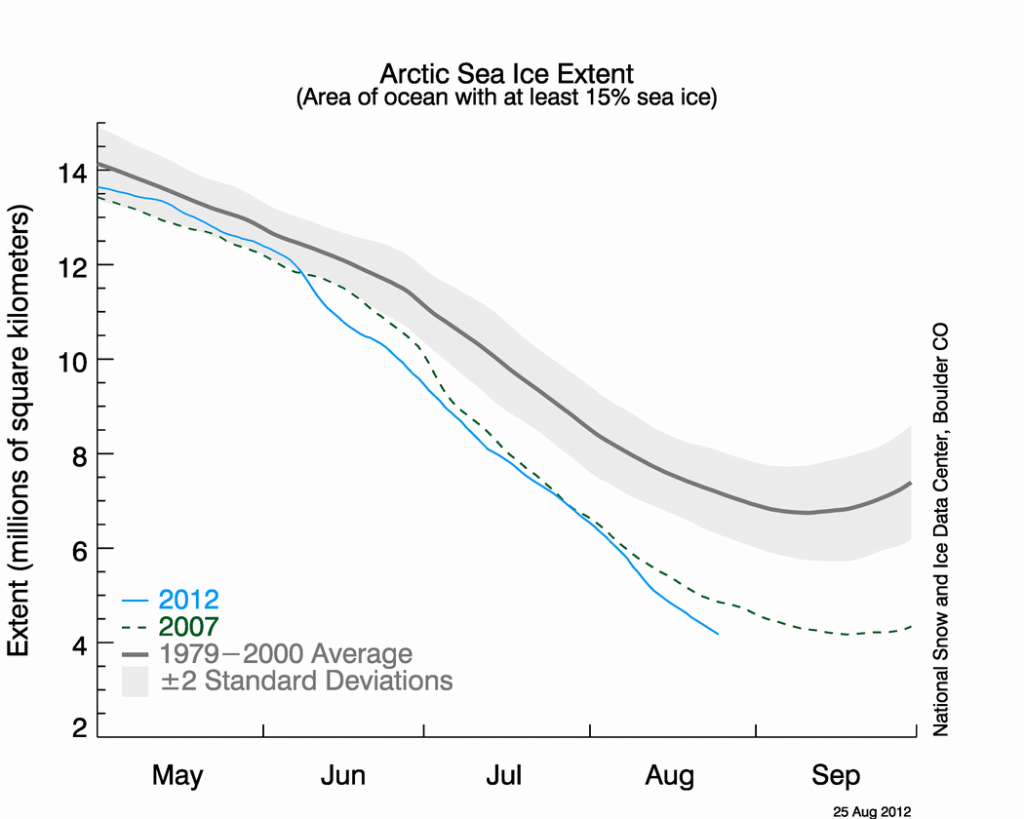
And finally, the big one has fallen. The most widely watched Arctic science source – the National Snow and Ice Data Centre – is showing a new record minimum has been reached today.
The automatically generated graph below shows *both* the lines for the year of record, and the current year. Notice anything?
They’ve updated the image now so that it shows 2007, which held the previous record, and 2012 which is now the record.
There is only one line…… the record is now.
The actual numbers. (Hattip Neven)
1980 | 7.5247 million square kilomtres (highest in satellite record since 1979)
2007 | 4.1607 million square kilometres (set on September 14th)
2012 | 4.0892 million square kilometres (and running)
(reduction of 45%)
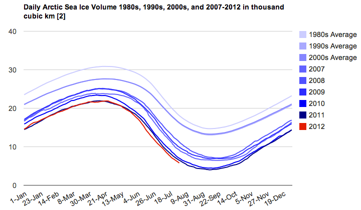
Here is the ice Volume data from July (August should be out late next week) (because we all know there is more of the ice cube under the water than on the surface) (hat tip Arctic Institute)
The ice [coverage] in 2007 and 2011 was roughly the same with 4.3 and 4.61 million square km, while ice volume decreased from 6.53 to 4.2 thousand cubic km showing how ice volume is decreasing at a much more rapid pace than ice extent.
Just think what happens to ice volume when extent smashes records. There are around 2 more weeks left in the melt season.


