It’s going to be a beauty out there today. The low cloud should burn off by mid morning and reveal the clear blue skies that are above.
Today and tomorrow will be a grand day for a walk. There are plenty of little streams to check out.
Next week is gong to be a wet on and off… But warm! Check it out!
Who know maybe if we’re lucky we’ll get close to 20 🙂
In wider news:
Brett Anderson at Accuweather just updated his long term forecast which shows going into May cool or seasonal in temperatures and starting to move toward drier than normal conditions.
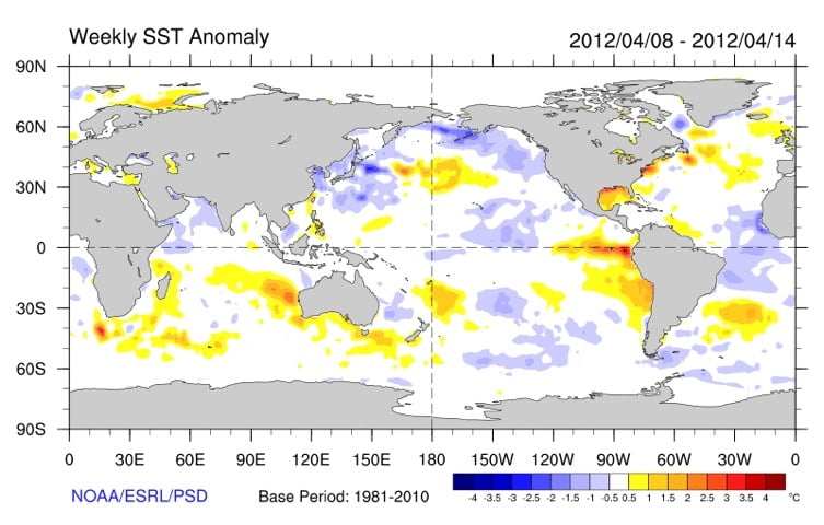
La Nina was officially declared over yesterday. We have now moved into Neutral territory and most forecasts are predicting a weak El Niño for the fall and winter. Since the transition has been quite gradual the La Nina like weather patterns will take a while to dissipate and so will persist for us probably into early summer and El Niño type warmer, wetter, patterns likely wont take hold until Fall if the waters indeed keep warming off of South America.
Closer to home, we are still being heavily influenced by the cold phase of the Pacific Decadal Oscillation. You can see the data (bottom of page) here that shows it has been gradually warming since bottoming out last July at a -1.89C anomaly. The latest data for February show a -0.85C anomaly and current SSTs look to be continuing that trend as they approach 0C anomalies (in white below)
It all adds up to what should be a much less chilly and unpleasant summer, fall, and warmer winter (perhaps no 567cm base on Mt Washington next year?)


