Saturday 8AM update.
I will keep updating this post through the weekend.leave a comment below or on Facebook or twitter I’d you have a question or want to jump in. All comments welcome!
The rain is here, it should accumulate all weekend. It doesn’t look like we will get anything too epic. I’m still betting on 80mm by Monday morning. The wind potential is much more interesting. Yesterday’s model runs presented a potent low sweeping across the Island right near us, which might mean very strong winds if it’s positioned just right.
This was yesterday 10AM release, it got me reall excited, a pretty deep low, ashore over Tofino with 100kph winds in Barkley Sound likely coming up the Inlet.
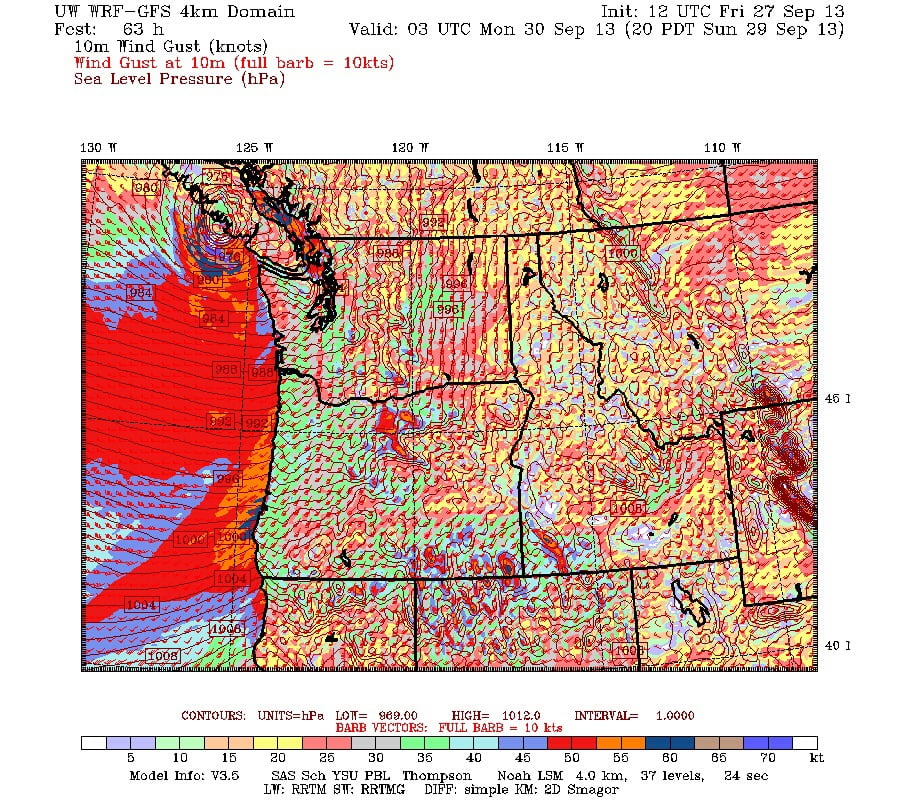
And this was the 10PM release, it had the low a little further south (directly over us. So likely a little less wind.
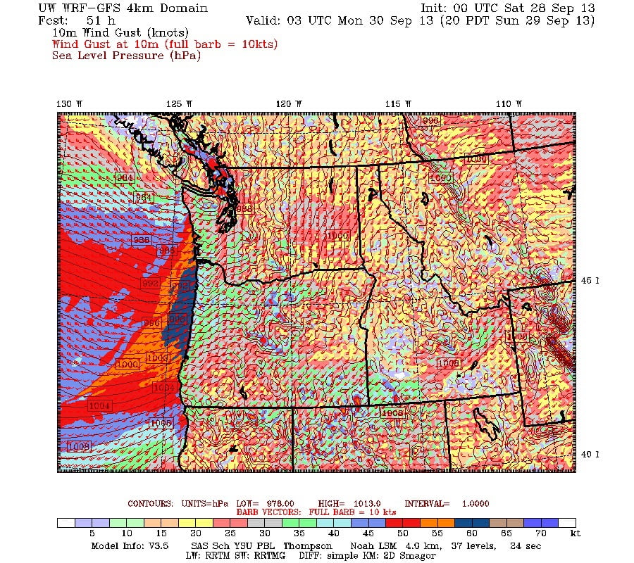
I will update this post again once the new update comes out after 10AM. Fun times! Love this time of year!
………..
The rain for today is already stopping. It will be showery this morning but dry for the rest of the day, so I will focus on the weekend.
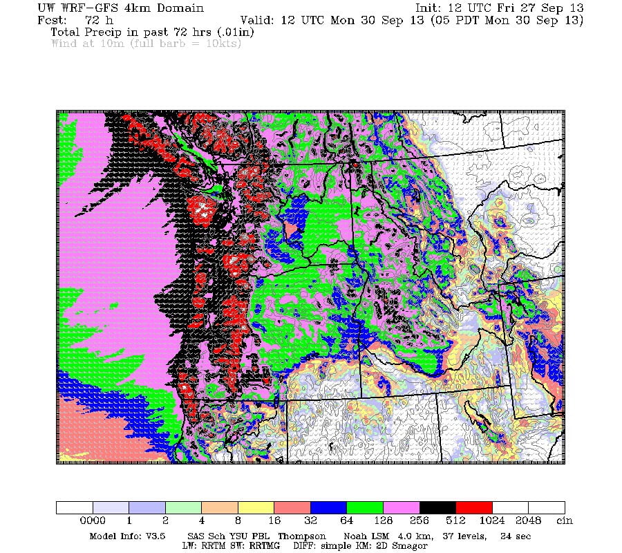
The map below shows total rainfall between 5PM Friday and Sunday. It’s hard to pick out our little area, but we are right on the edge of the purple and black regions, which means, on this map between upper limits of 2.5 and 5in — 60 to120mm — of rain will fall. I will expect around 80mm maximum in Port. But if you are on the West Coast, expect 120mm or more. The rain will start overnight and won’t let up until Saturday evening but will be quickly followed by a slightly weaker and more southerly front on Sunday.
Image is updated to 11AM version, more rain expected for west coast (200mm in places) but same for us.
I am less concerned about the wind than I was yesterday. The strongest parts of the storm both Saturday and Sunday seem to be shifting a bit South, but you can still expect some strong winds on the East Coast and at least some ferry cancellations are still possible.
As the truly beautiful Microwave water vapor imagery animation (one of my favourites) shows, the moisture we are going to get (part of the big blog you see below near Alaska) will be semi tropical and was part of the remnants of Tropical Storm Paluk at one time near Japan.
Click the image below to see the animation.
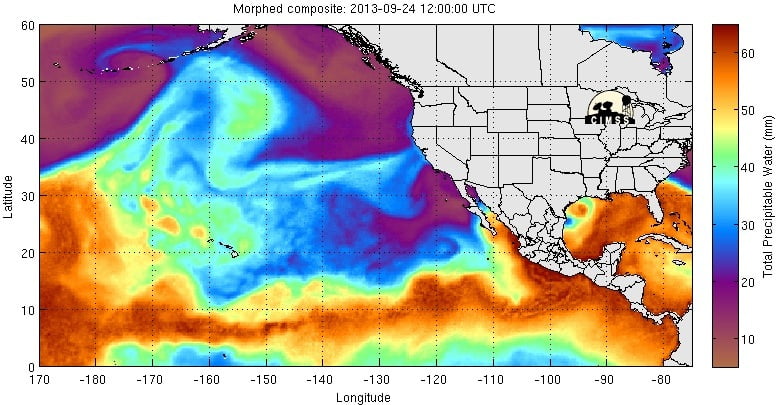
It will thin out before it gets to us, don’t worry. 🙂
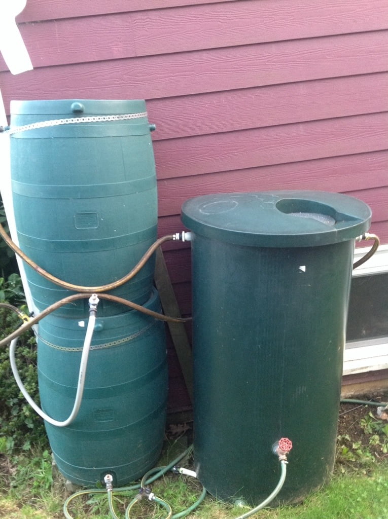
Oh! I forgot! I was going to put a pic that I put on the Facebook Page last night of my water barrels / flood prevention and runoff calming devices! So here they are in all their utilitarian glory:
They do make a big difference for us, not only because they end up redirecting to the back all the water that usually goes in front of our house, where the drains sometimes can’t handle it and it ends up in our basement, but also just to restrict the water flow so it doesn’t all eve up going into the drains quite so quickly.
After the cost of the barrels, the other stuff is pretty cheap. Just a bunch of old hose cut up into appropriate lengths, added hose ends, and a couple Y connectors and it all goes pretty well.
>
>
>

Comments
One response to “Update 8AM Saturday: Big Rain: up to 120mm (5in) of rain between Friday and Sunday evening.”
Don’t throw in the towel on a windstorm just yet. Models showing a deep but small low crossing the south/central Island later on Sunday. Depending on the track, it could be a big blow for someone. I know things have trended south, but often when it comes down to crunch time, these things end up wobbling to the northwest.