A Break from the Rain!
Here’s the Youtube Podcast for this post!
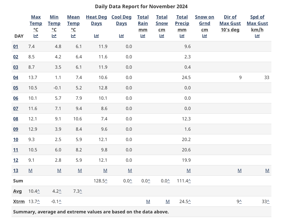
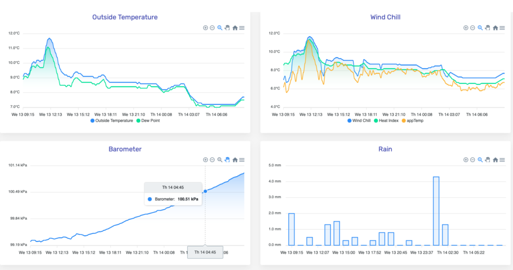
We will get a nice break from the downpours and strong winds Thursday and Friday. While we didn’t see a lot of wind in the last storm, we certainly got a decent amount of rain, about 60mm over the past 3 days at the Airport and about half that at this station.
Cooling and clearing Thursday and Friday – nearing King Tides – Possible Frost.
The good news is we will clear today and Friday. We should have some pleasant skies to see the moon. Note we are at the full moon and at this time of year we are also seeing the tides build toward the December King Tides. With all the rain in the mountains, expect high levels for the Somass River especially at those high tides.
We could see frost in the deeper parts of the Valley on Friday morning you can see below that the chart does have some areas below zero (light blue) just to the northwest of the Alberni Inlet.

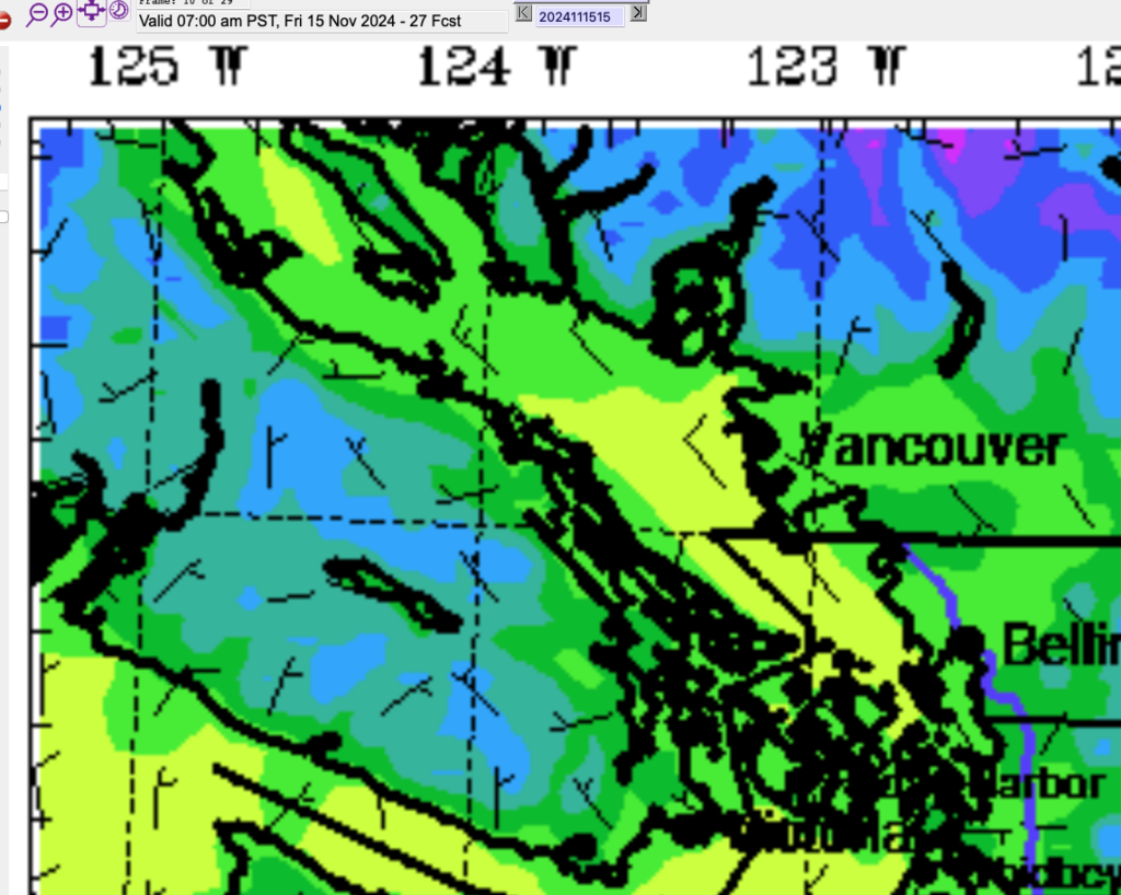
There will also be fog though so that will moderate the temperature and probably keep us just above freezing in the City of Port Alberni. Expect freezing temperatures on the Hump and Sutton Pass. There will be a possibility of black ice.
Friday Night – Saturday – Possible Slush Higher Elevations
We might be in for our first messy winter system on Saturday as a strong rain system comes in from the northwest.
Below is the picture for 10PM-1AM Friday/Saturday night. You can see that cold air sticking around the higher elevations.
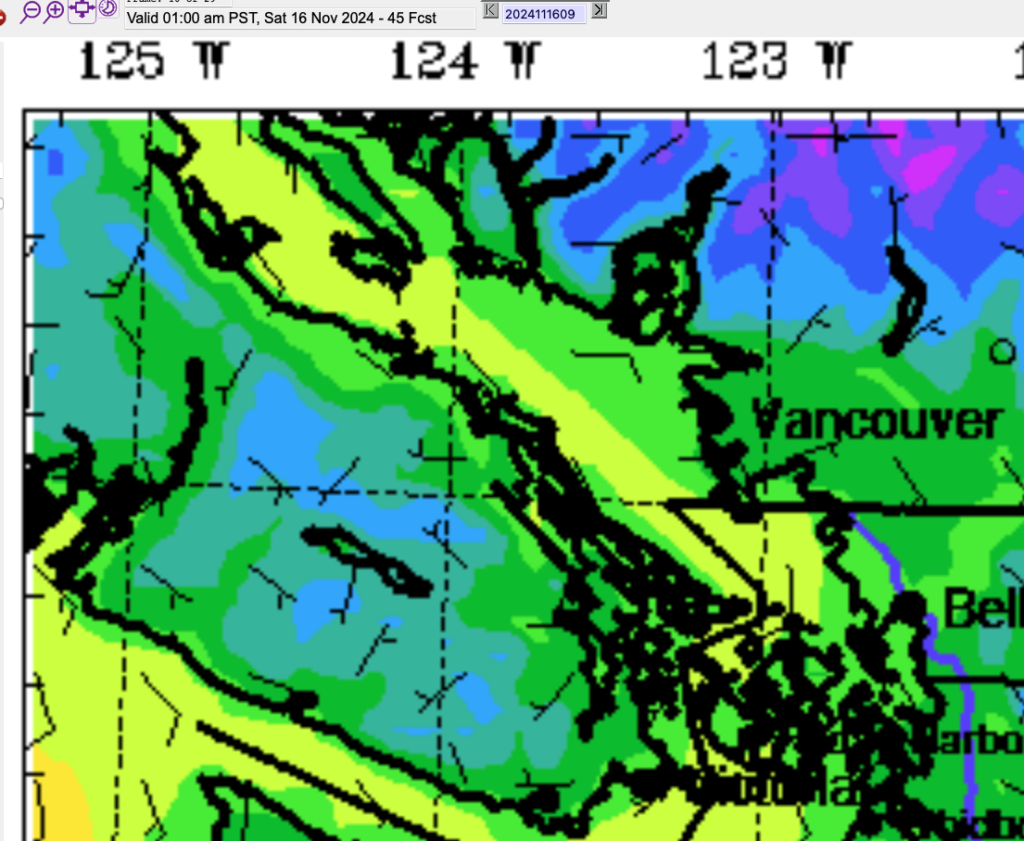
That adds up to a mix of rain and snow at higher elevations on the models when the next system moves in on Saturday morning.
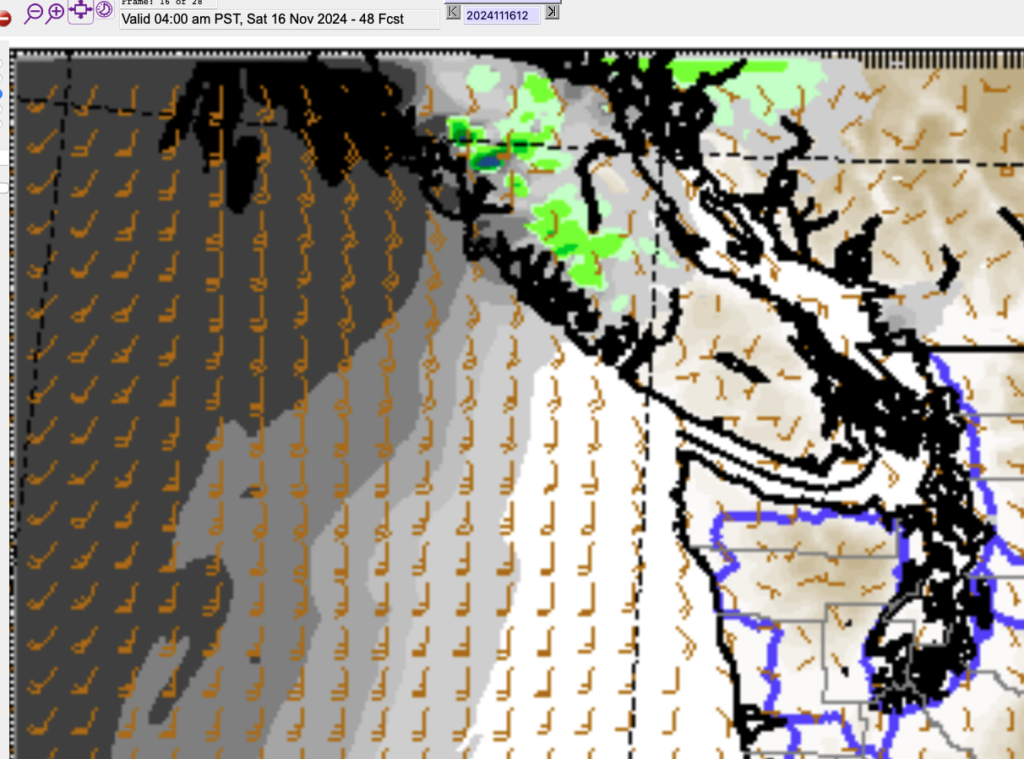
I would expect changing conditions on the Hump and Sutton pass on Saturday morning especially. It could start as rain, and then if the rain is stronger it could switch to sleet or snow very quickly.
The threat of sleet or snow should end by the afternoon on Saturday as everything warms and turns to rain thanks to the Southerly breeze. And about that breeze.
Ferry Cancellations possible Saturday
If you’re planning on taking a ferry this weekend, you should make the crossing on Friday night and Sunday. Saturday has the very real possibility of strong winds on the coastal sections of the Island up to 80-90kph. More than enough to cancel ferries in the day on Saturday. The ferries should run in the morning but expect late morning and afternoon runs to risk cancellation.
Right now the strongest winds look to start on the East side of the Island by around Noon.
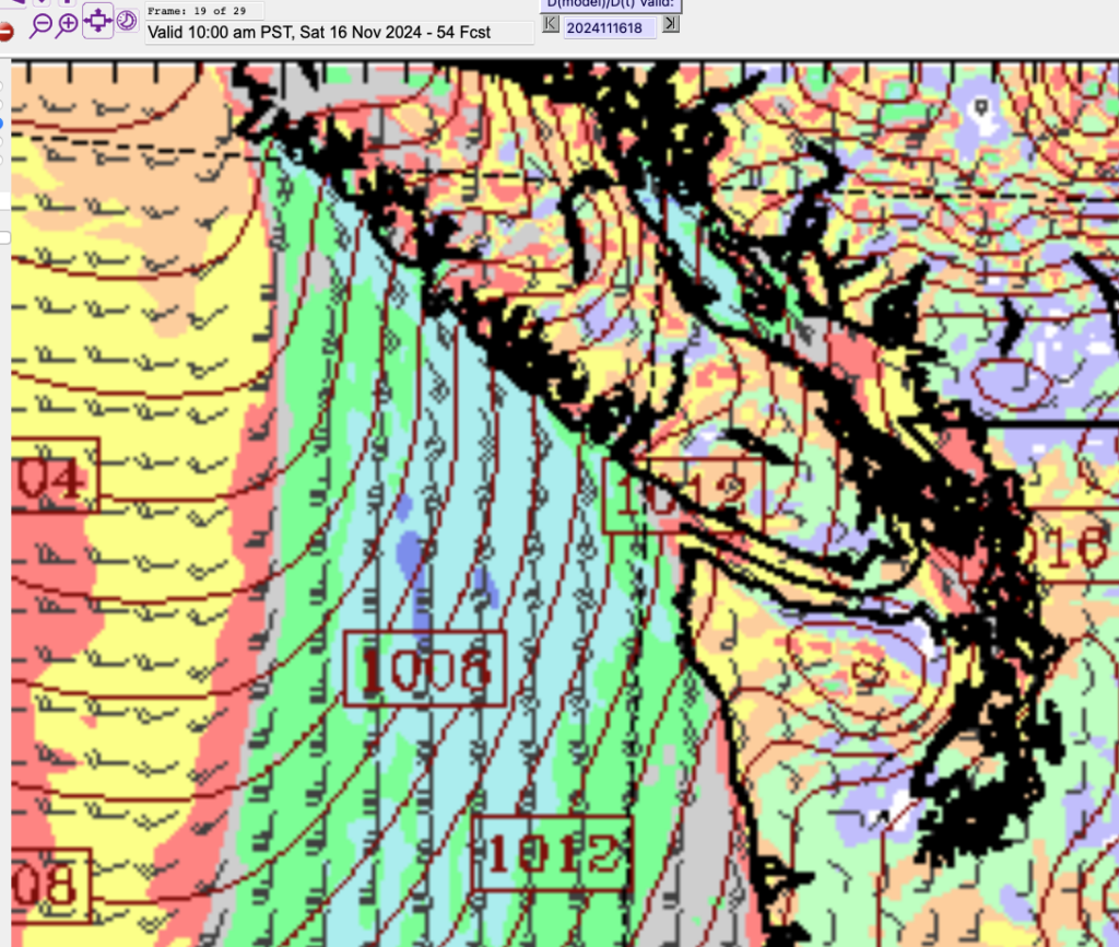
The good news is it is a shortlived event. The winds should calm overnight on Saturday and we’ll have a break on Sunday.
La Niña weak but might still influence Winter
The latest forecasts from the El Niño Southern Oscillation forecast centre was released this morning. They say:
There’s a 57% chance La Niña will develop soon. This is late for La Niña to arrive, and it’s very likely to be a weak event at most. However, even a weak event can influence temperature, rain, and snow patterns across the world.
Here is their chart showing the probabilities of La Niña (blue), Neutral (Grey) and El Niño (Red) conditions.
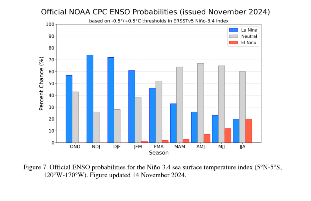
Each set of bars represents three months. The first is “OND – October November December”. As you can see, the models and forecasters expect La Niña conditions over the winter to about February or March. However, their discussion emphasizes that this looks to be a weak event:
Due to this guidance and La Niña-like atmospheric circulation anomalies over the tropics, the team still favors onset of La Niña, but it is likely to remain weak and have shorter duration than other historical episodes. A weak La Niña would be less likely to result in conventional winter impacts, though predictable signals could still influence the forecast guidance (e.g., CPC’s seasonal outlooks). In summary, La Niña is most likely to emerge in October-December 2024 (57% chance) and is expected to persist through January-March 2025 [Fig. 7].
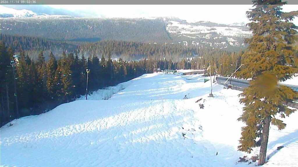
La Niña generally bring us cooler and drier winters. However, with this being a weak La Niña we might not see the big cold snaps that we would otherwise expect in January or February or big snowfall totals. We may see more precipitation in the form of rain rather than snow. That said, a slightly cooler, but also wetter winter might be exactly what the local ski resorts are looking for! Mt Washington is starting to get some snow on the webcam!
Cold Snap in late November – Snow?
Speaking of cold and snow, I had a look at the long range forecast in the Podcast and check out what it shows!
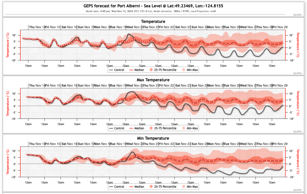
It looks like after a final rain storm next Wednesday we get into the possibility of a cold period. It looks mostly foggy and stagnant but it looks like we will stay in the 0-4ºC range and possibly go below that which could lead to some snow.

The model predicts 15cm of snow by the end of the month. We’ll see!
A few small updates to the website.
You should see the forecast tabs on all pages now. You should also check out the new ‘NeoView‘ Almanac view that I’m testing out. I’ll be tweaking that new view over the next few days and weeks. Let me know if you like it!
That’s all for today! Have a great weekend and stay safe out there.
ool

