Bundle up on Monday the wind will be cold.
If you were on Facebook or twitter last night you would have seen us chatting about the dumping that Nanaimo and other East Coast communities got.
The low pressure that was supposed to go right over our heads instead slid south and brought easterly and northeasterly winds that dragged ‘Strait Effect’ snow to the East side. They got a good 5-10cm or more in parts. Unfortunately for snow lovers like my wife, when the East side gets strait effect snow we tend to be in the shadow of the Beauforts and don’t get much at all.
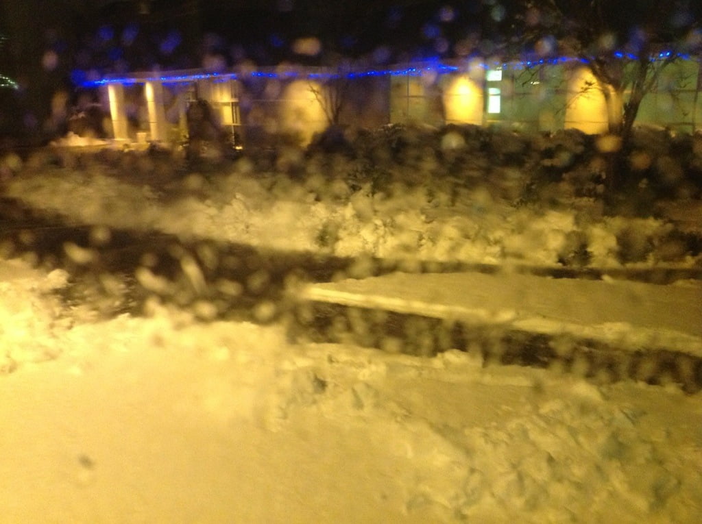
Here is the Ravensong pool this morning. Sorry that it is through the window of the bus.
The hump was pretty bad all night but is cleared this morning and the snow has stopped falling. Sutton pass is the same apparently. Parts of Sproat Lake also got snow on Sunday through the day though not as much as this.
That may not be the case Wednesday.
Monday will be a day of cooling. The winds have shifted to the West and will shift again to the NorthWest as high pressure builds. This will envelop the whole Island in below zero temps by tonight.
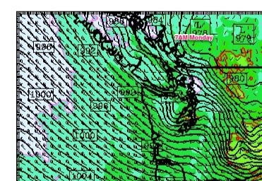
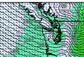
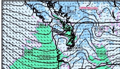
By tonight we should be well below freezing. EC is forecast -3 tonight and UWash/GFS agrees.
The cold should persist through Tuesday.
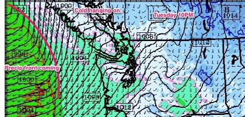
On Wednesday morning we have the potential for significant snowfall.
The models don’t have the precipitation reaching us until around 10AM on Wednesday so it shouldn’t be bad for the morning commute at least. But none the less, we will have to keep our eye on the temperatures. The deeper you are in the Valley, Beaver Creek, Sproat Lake or Cherry Creek, the more chance the temperatures will stay below freezing and you will get more snow for longer than in town. But you guys are used to that. Also, because it is a fairly strong rain event, the heavy rain itself will cause the atmosphere to cool and more will fall as snow than might otherwise.
I will of course have more on this tomorrow as we get the final forecasts in.
The snow contest might have a winner on Wednesday. I will have to figure out whether it will be Lynn or Glenn Priest, as they are the closest guesses on the calendar, but I’m thinking Glenn.
Snow shovels READY! 🙂
Oh.. And I am expecting my weather station Tuesday. I will try to get it on the roof Tuesday night so that it is ready for the fun on Wednesday morning… But everything will have to go perfectly for that to happen.

Comments
6 responses to “East Coast gets dumped on, our turn Wednesday?”
I just had a question, you say we have the potential for significant snow on wednesday Dec 19. but the weathernetwork and enviornment canada both say rain. How do you determine snow if no one else is predicting that? I was just curious I love all of your updates, and I really really want it to snow but the valley usually seems to get left behind when it comes to snowfall. Thank you so much.
Hi Weather Girl! 🙂
EC didn’t predict Nanaimo would get 10cm of snow last night either. ;=)
A shift 0.5C this way or that can mean the difference between rain and a bunch of snow… so the reason I say there is potential for significant snow on Wednesday is because generally, we get snow in Alberni when we have a period of below-zero weather followed by a Pacific front that pushes in from the water. That’s what we’re setting up for Wednesday. It’s not going to get REALLY cold, but it should be below zero tonight and through tomomorrow. EC/TWN is likely thinking the warm air will come in faster with the front and so we won’t get any snow. I think the cold will stick around a bit longer and we’ll have snow followed by slush, rain, etc.
All we can do is wait and see! 🙂
thank you so much for the quick reply that clears up my question. Keep up the good work love this site!! 🙂
Thank you very much for visiting and commenting! 🙂
I agree Chris, it looks like a classic set up, and it always depends on how cold it gets and how long it takes between when the moisture arrives and when the temperature warms up. The NOAA winter weather forecast charts look pretty certain that inland Vancouver Island will get snow during the day on Wednesday: http://www.hpc.ncep.noaa.gov/wwd/day3_psnow_gt_04.gif
I hear branches outside cracking from the weight of snow – you must have a winner in the snow contest now!