EC has reissued the Special Statement on the coming Heat with a caveat (It’s below or link here). There is some indecision in the latest model runs on whether our heat breaks on Monday or Tuesday. The ridge that is baking the Western US is proving not to be reaching quite as far North and West as originally thought. We are just on the very edge.
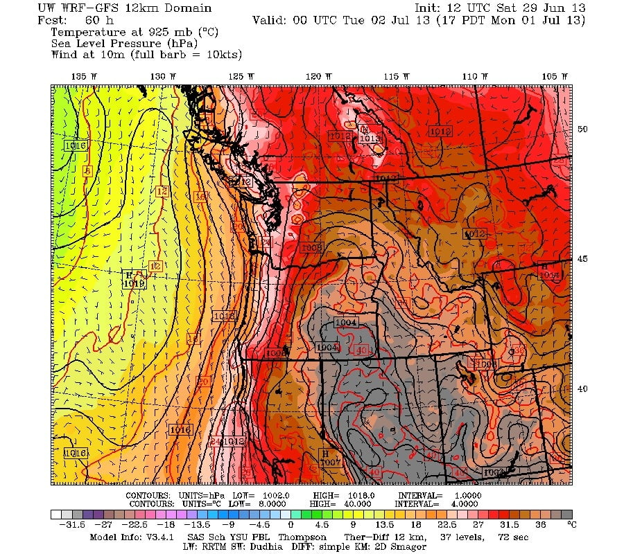
We will still get sun, but the major heat might not be quite so major, it will be close. You can see the tightly packed lines running along the coast in the image below. Monday will still bring temperatures into the high twenties (the pink areas below).

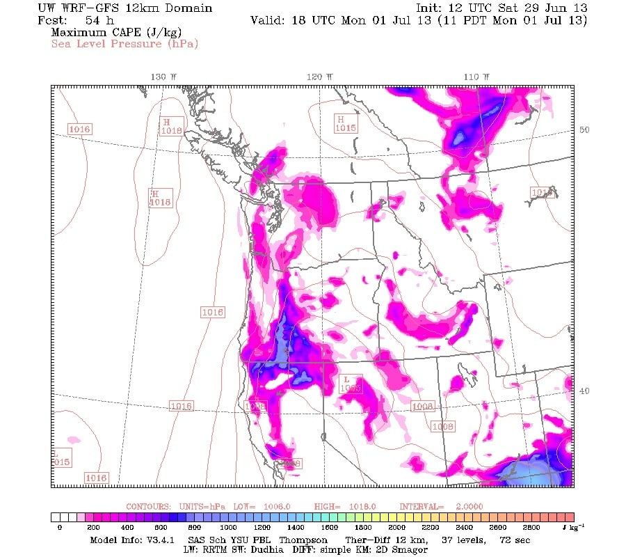
There is also a chance of thunder storms. The image below shows “Convective” Energy, which is what creates the big thunderclouds! Slightly more southern regions of the Island, and Nanaimo are most likely to get some rumbles late Monday Morning through the afternoon and evening.
I think we can probably be happy that it isn’t going to be 34C like we might have thought. Instead, a very pleasant high twenties but maybe a little humid. As of Tuesday a ridge of high pressure is going to build in from the Pacific…
I think the heat will start to build again Wednesday and Thursday, but it’s pretty far out.
Here is the Heat Statement from EC, it will still very much apply to the Interior and likely the Fraser Valley too.
Issued at 2013-06-28 23:56 UTC by Environment Canada:
Special weather statement issued for:
Inland Vancouver Island, B.C. (081500)
Current details:
Hot weather develops on the Canada day weekend.
After a sputtering start to the season, summer is about to arrive in spectacular fashion. A massive ridge of high pressure will develop on the Canada day weekend. The ridge will bring hot air from the desert southwest of the us to the BC coast. The cool sea-breeze cycle that usually provides relief from the heat will weaken, and the temperature of the somewhat humid and stagnant air over the South Coast will rise to near 30 degrees inland on Sunday. Many daily maximum temperature records will be set Monday as thermometers climb into the low to mid 30’s.
Some of the latest model projections suggest the heat may break a little earlier, perhaps on Tuesday rather than Wednesday. Whenever the heat breaks, cool, marine air will spread inland, lowering afternoon temperatures by 5 to 10 degrees.
If the marine air remains offshore and temperatures are expected to persist into the mid-thirties for more than one day, this special weather statement will be upgraded to an ex treme heat-wave advisory for some regions.
Coping with the heat.
There are many symptoms of heat-realated illness including thirst, dizziness, confusion, weakness and fainting/collapsing. Medical health officers are reminding residents to protect themselves from the heat.
1. Stay hydrated. 2. Keep cool. 3. Check in on others. 4. Get informed. For more information on heat-related illness, call healthlink BC at 811.
The public is advised to monitor future forecasts and warnings as warnings may be required or extended.


