Weather Watchers in a Tizzy – It could be much worse.
Here’s the Podcast!
I’ll just start with the image I woke up to this morning from the University of Washington, the picture for Tuesday night:
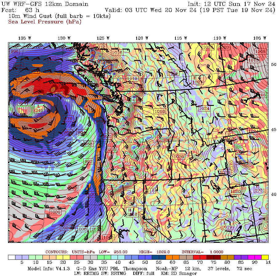
Now that is a storm to behold. A minimum pressure of 94.9kPa (949hPa or millibar). Peak winds offshore of 80knots (150kph) and 65knots (120kph) off Barkley Sound and along the Oregon Coast.
That is a beast. A product of “Rapid Intensification” or “Bomb” when two lows merge and the pressure drops extremely rapidly creating strong Hurricane Force winds.
So far – this is not looking dangerous.
The good news is the storm appears to be staying offshore in its most intense phases. Rather than ramming into the Pacific Northwest coast at full speed, it’s going to do a button-hook (there’s my Football Reference for the Grey Cup today, go Bombers) and the storm will weaken while it is still well offshore.
But let’s look at how NOAA forecasts are seeing this storm. We’ll look at the Ocean Prediction Centre for the Pacific.
The following three images show how the ocean forecasts see it. The low develops from Monday afternoon (Nov 19, 00:00 UTC) to Wednesday morning.
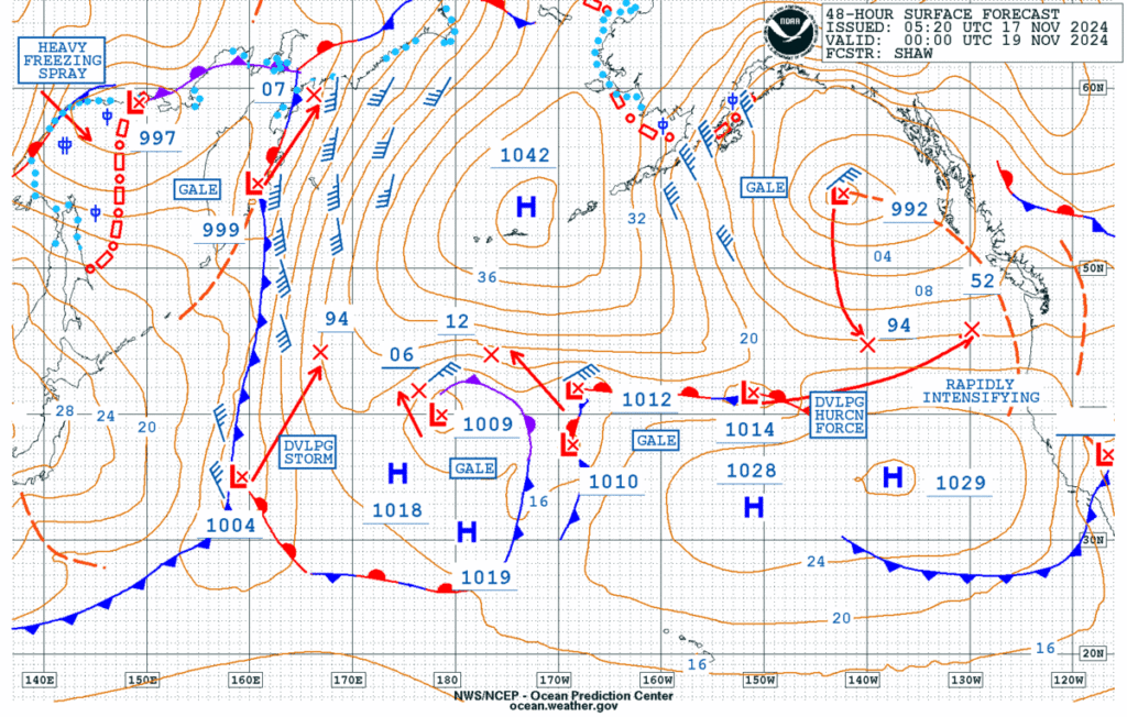
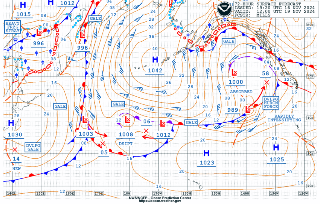
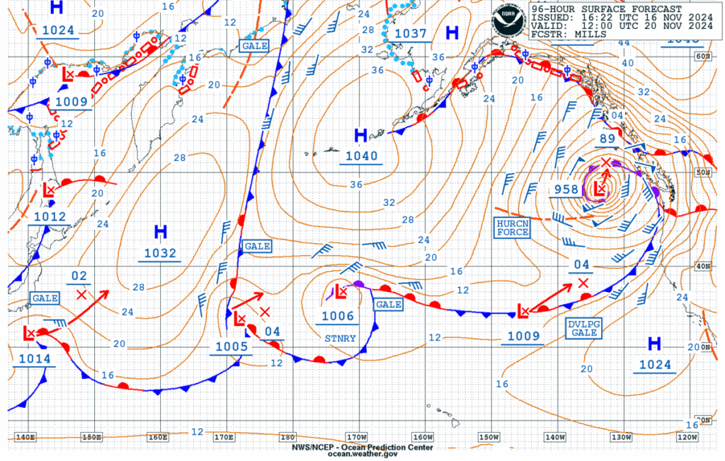
If you look at the right side of the image near Vancouver Island you’ll see two “L” lows, one above the other. They get “absorbed” into one, and then “Rapidly Intensify” into a 958mb low in the bottom image.
What to expect for Vancouver Island – Unsure but Potentially Damaging
As I’ve said, the good news is this is mostly staying offshore. BUT if it comes any closer, we could see extreme winds in Georgia Strait, across the Island and in Metro Vancouver.
For now, what the model is showing is that it will get just close enough to deliver extreme winds to the West Coast, with less extreme winds in Georgia Strait.

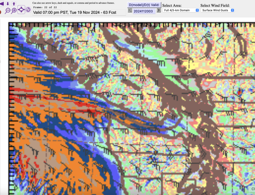
The image above shows unusual easterly winds off the beach at Bamfield, Ucluelet and Tofino and in the Strait of Juan de Fuca from 60-70knots (120-130kph).
I am a little worried about the blue patches of 40-50knots along the Alberni Inlet. You can see them along the right (east) side of the Inlet in the zoomed in picture below.
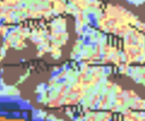
We don’t usually get Easterly gales like this. It is predicting 45knots (80kph) ESE.
Mountain or possible East side Snow
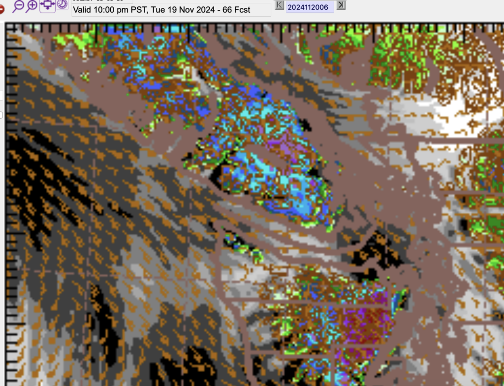
What seems a little more sure is that these strong outflow winds will pull some cold Arctic style air and may dump a significant amount of snow on the mountains. The blue shows snow in the image below sticking to the higher elevations with rain elsewhere including in the Valley but Cowichan might get some snow out of this.
Still early – Stay Updated.
This is a potentially destructive storm if it decides to move in a little closer so I’m going to keep an eye on it as I am sure many others will as well. There will also be an Atmospheric River associated with it impacting the Oregon and California coast which could cause a lot of damage in fire-impacted areas.
