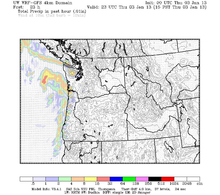
There is a weak system on its way for tonight that might give us some flurries once the sun goes down. The map below shows the first very light wave should hit around 5PM, the second stronger wave should hit between 7 and 9 PM.
Neither will be hugely significant though. No more than around 10mm. It is chilly around the Island today, including here in Alberni at -1C at the Airport and 0C in town so expect a mix of wet flurries, possibly some sticking, and be careful on the Hump and Passes.
Saturday and Sunday are looking more widespread with up to 20mm showing in the models and still cool, no higher than 3 or 4C.


Comments
6 responses to “Possible flurries tonight”
Hey Chris, not sure if you watch the ECMWF model runs, but todays 12z was nice. Some good potential towards the middle and end of next week.
I don’t seem to be able to find a good source for ECMWF runs. Where do you get it from.? I see on the UWash extended outlook its looking like our first real cool down on Wednesday. Hope it holds! I have also seen the monthly and seasonal forecasts seem to be trending cooler than normal and dry for this month but cooler and not so dry for Feb.
try ecmwf.int then click on forcaats under the products, you can view north america on here.
or try
wunderground.com/wundermap
These links might take you more directly to the euro info I hope, saves looking around the sight to try to get where you want to go, Its a bit confusing.
http://www.wunderground.com/wundermap/?zoom=4&rad=0&wxsn=0&svr=0&cams=0&sat=0&riv=0&mm=1&mm.mdl=GFS&mm.type=SURPRE&mm.hour=0&mm.opa=100&mm.clk=0&hur=0&fire=0&tor=0&ndfd=0&pix=0&dir=0&ads=0&tfk=0&fodors=0&ski=0&ls=0&rad2=0
and
http://www.ecmwf.int/products/forecasts/d/charts/medium/deterministic/msl_uv850_z500!Geopotential%20500%20hPa%20and%20Temperature%20at%20850%20hPa!0!North%20America!pop!od!oper!public_plots!2013010400!!/
Sorry, 1 more tip, on the wunderground link you have to scroll down on the right hand side, then select the blue sprocket looking tab, next to model data, and select ECMWF. You can view all kinds of great forecast data for western north America from there.
awesome thanks monty! I have the .int link but it doesn’t work on my iPad which is what I use most of the time to post blogs… But that Wundermap is works like a charm!