Long duration event – winds start Tuesday afternoon into Wednesday.
Subscribe to the Alberniweather podcast!
The models have come to agreement and the good news is that the core of this very impressive storm will stay offshore. However, we will still get very strong winds here, 400km away from the core!
The storm will be at its strongest, getting down to a pressure of 948hPa, early Tuesday night in the 4-7PM timeframe.
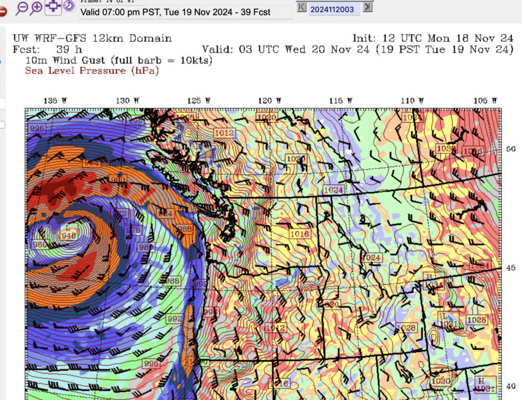
The deep red areas in the swirl above are winds gusting to 75knots or 140kph. Closer to home, the low will fling a front toward the Coast with winds up to 65knots (120kph) at the mouth of the Juan de Fuca Strait. Winds on the shore of the East and West coast look to be in the 50-55knot range, up to 100kph. This thing means business. We’re all glad it’s not coming any closer!
When to expect high winds (Ferry cancellations) and the unusual direction
Around Noon Tuesday – The image below is for the 10AM-1PM period and we can already see East and Southeasterly winds in the Strait of Georgia at 30knots/55kph. That will already be approaching the point for Ferry Cancellations.
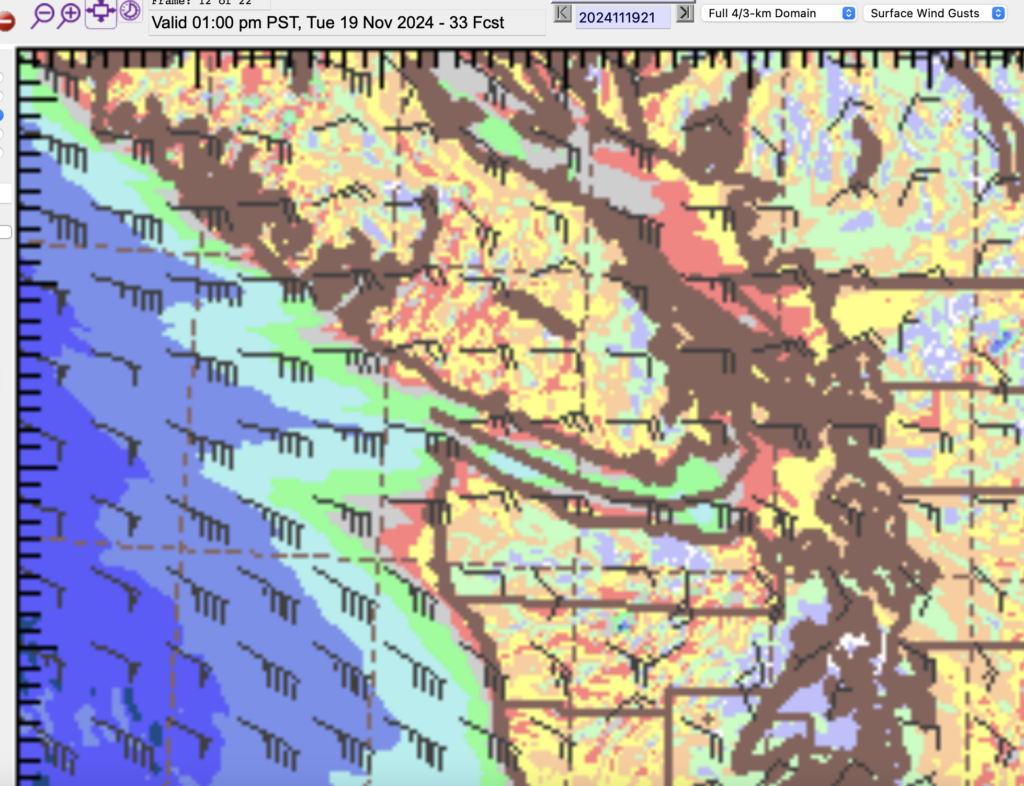
So while Tuesday morning Ferries should be OK, I would be wary of anything after 12PM.
Winds will continue to build through Tuesday afternoon. The model has both Easterly and SouthEasterly, which is a little unusual. Usually we just have storms with strong Southeasterly, South or SouthWesterly winds. The unusual direction is because the storm is staying offshore before moving away and weakening.
You might find that the winds start on Tuesday from the East and then they should gradually shift to the SouthEast in the evening and overnight.
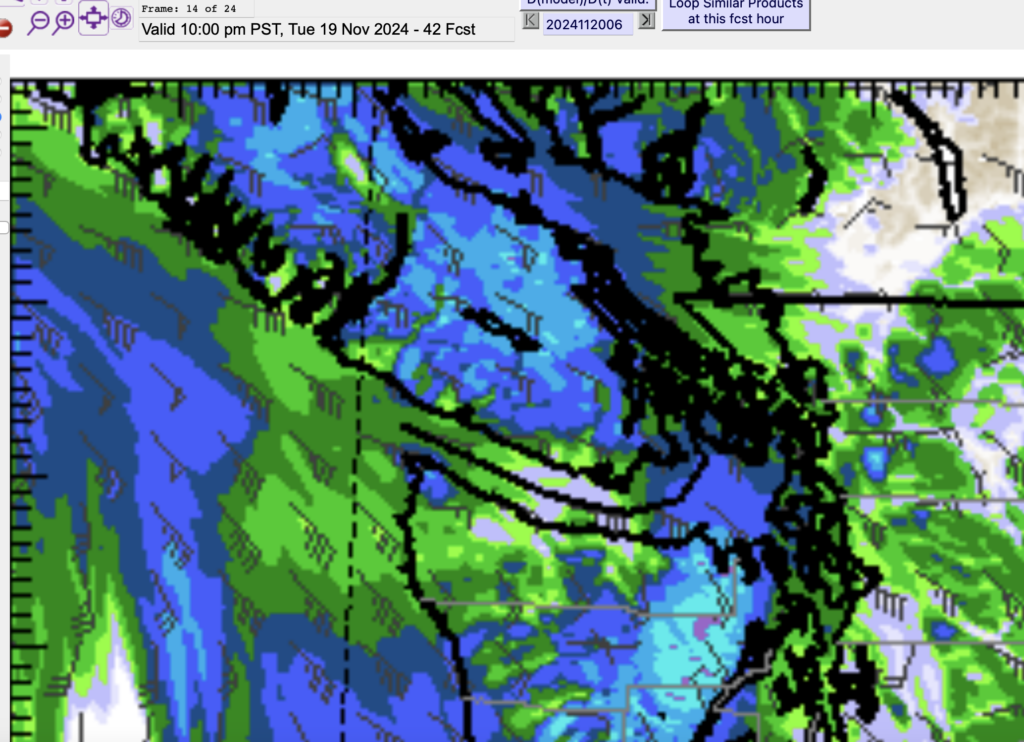
Below is the 4-7PM picture which appears to be the peak of the storm.
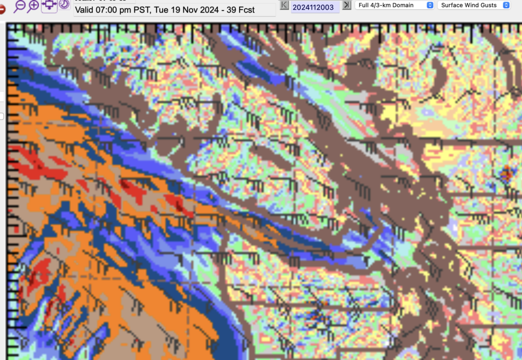
There will be 100kph winds possible all around the East, South and West coasts of Vancouver Island including Victoria. Those will cause power outages.
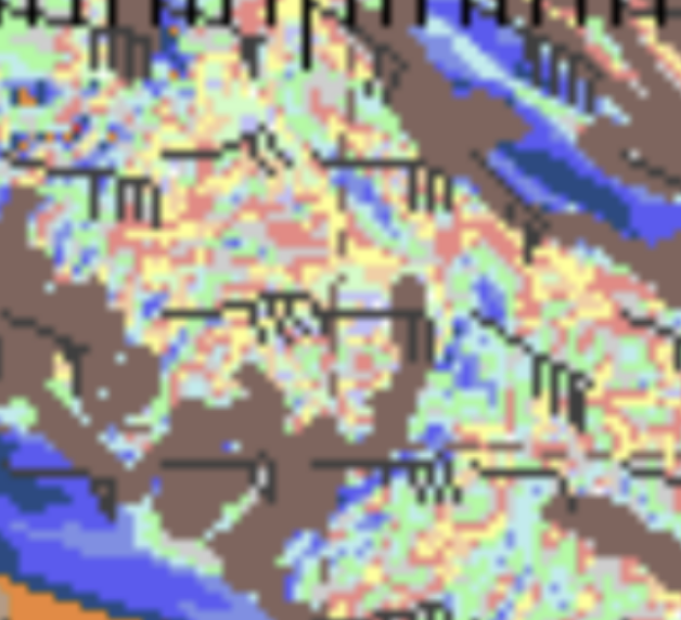
But my greatest concern is actually for the Alberni Valley. Because the Valley is oriented in a Southeast to Northwest direction (like the Island itself) we are more likely to see strong winds when they match that Southesterly (or Northwesterly) direction.
If you to the image at the left here, around the Alberni Inlet and Alberni Valley, you’ll see some pockets of blue 50knot (90kph) winds very close to the Alberni Valley and shore of the Inlet.
We don’t usually see that kind of indication on the model, so I think we have a higher chance than usual of very strong winds in Port Alberni
The strong winds will blow through the night on Tuesday and into Wednesday morning. I would not expect things to calm down until around noon on Wednesday. So this could be a full 24 hour event.
Rain too — possibly with wet snow to start
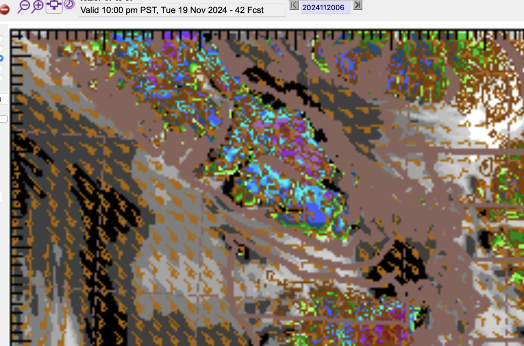
Rain will accompany this system as it lands overnight Tuesday. Rain should begin before 10PM across the entire Island but focused mostly on the East side and the higher elevations.
There will be higher elevation snow as well, and some of that snow could creep down to the mountain passes at the start of the storm. There is a possibility of blowing wet snow or sleet. You’re not going to want to drive in that!
Break Thursday – then weaker storm Friday.
We will get a break on Thursday but another storm will follow a more traditional path into the North Vancouver Island on Friday. It does not look to strong but we’ll keep an eye on it just to be sure.
East Webcam offline.
Unfortunately the cable for the east facing webcam has shorted. I’m determining whether the camera itself still works but for now it is offline. The others are doing well though!

Comments
One response to “Possible high winds for Alberni Valley from distant “Bomb Cyclone””
[…] for watching! Check out the podcast and post from earlier today to see what to expect! I will try to put up a new podcast and/or post tomorrow morning or tomorrow […]