First… look! its the moon and Jupiter!
Another beautiful clear cool morning.
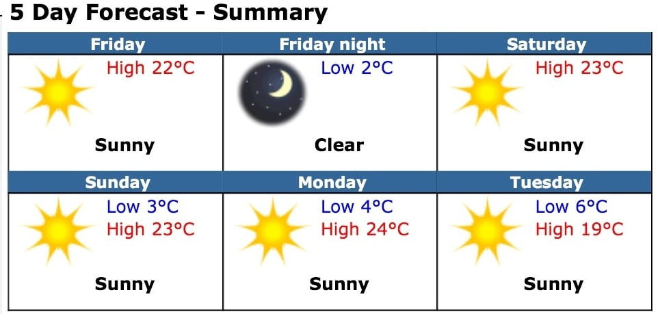
The short term forecast remains beautiful and warm. With temps likely breaking records starting today through Monday.

Today’s record: 20.7C (2001)
Tomorrow: 21.6C (1998)
Sunday: 21.3C (2000)
Monday: 20.8 (1996)
Tuesday: 23.0C (1996)
Long Range, It’s still forecast ping pong these days with the GFS model. Yesterday’s 0Z (4PM) run of the short and long range forecast had a grand total of 5mm of precipitation between now and the 20th.
On last nights 6Z (10PM) run it’s as if we went into another universe… It predicted 140mm.
I won’t bother putting up the images since it is most likely going to change again with the 12z (4am) run that should be out soon.
The important thing, however, is that the rain has now officially crept into the short term 7 day for next Friday. Nothing significant (13mm) so far, but its better than nothing and does look like a shift in our dominant high pressure pattern.


Comments
3 responses to “Record Thanksgiving Weekend and Forecast ping pong…”
Yikes, the GFS is now forecasting 55 mm for the Oct 12/13/14, and the next week over 100!
Ya the high pressure is definitely going to break down and finally leave us open to pacific systems but the first shot on the Canadian model doesn’t look all that impressive down south here, but the second shot looks like a real doozy. http://www.weatheroffice.gc.ca/model_forecast/animateweb_e.html?imagetype=model_forecast&imagename=12_054_G1_north@america@zoomout_I_4PAN_CLASSIC@012_….jpg
The last frame has the first shot over us… With the second lurking offshore. But will we get 140mm and avoid the record?