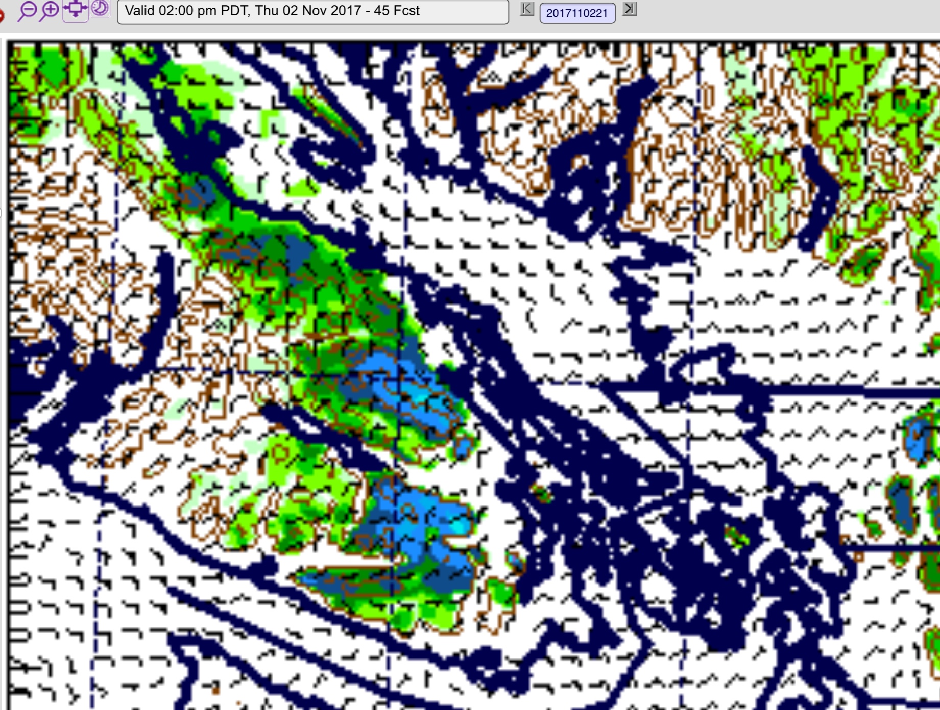
Update 5PM
Special Weather Statement issued at 4PM
Issued at 2017-11-01 23:29 UTC by Environment Canada:
Special weather statement issued for:
East Vancouver Island, B.C. (081300)
Inland Vancouver Island, B.C. (081500)
Current details:
Wintery Mix possible Thursday afternoon and Thursday night on the BC south coast.An arctic front will arrive on the coast late Thursday bringing much cooler air and strong outflow winds. It will also give a chance of snow or mixed rain and snow to many areas Thursday night.
In Whistler, rain is expected to change to snow tonight with 10 cm likely on Thursday.
Light snowfall accumulations are possible for Fraser Valley and Howe Sound Thursday afternoon and evening.
For other south coastal regions, any significant accumulation should be restricted to higher elevations.
Please closely monitor Environment and Climate Change Canada for the
latest updated forecasts.
UPDATE Models Updated… tweet summary below.
https://twitter.com/alberniweather/status/925804295647145984
https://twitter.com/alberniweather/status/925804935353999360
https://twitter.com/alberniweather/status/925805588809900032
https://twitter.com/alberniweather/status/925806354811437056
https://twitter.com/alberniweather/status/925807251993923584
——–
There are reports of a truck flipped on Highway 4 this morning. Expect Delays.
The snow contest could be over within 24 hours! But most of the snow probably is NOT in Port Alberni, but rather on the east coast.
Flurries will begin in the Courtenay area and possibly in Port Alberni around 8AM on Thursday and taper off by 11AM as it moves south.
The Nanaimo and Parksville area will then see some in the 10-12 timeframe and it will start in the Malahat area by noon as well.
In the later afternoon though is when real accumulations could start due to stronger northwest winds. We can see accumulations in the 11-2PM timeframe in the Courtenay, Bowser, QB and Parksville areas.
Notice though that the Beauforts are protecting Port Alberni so we might see only flurries in the sky but no accumulating snow (and so a winner i the contest is Not a sure thing!)
The snow will then turn to rain for most areas in the afternoon except maybe the Malahat between 2-5PM
Be careful out there folks. The roads will be slippery and the higher elevatoons will get the most snow. The Hump and Sutton Pass and possibly the Malahat could be treacherous for a short time.


