As I stepped out the door this morning it was snowing heavily again. We got another 3cm or so in town. The drive up the West side of the hump was pretty treacherous, far worse than yesterday morning ironically but this time as soon as I came down the East side all the snow disappeared and it was raining instead.
It will again depend on the temperature in your local area, but it should generally warm up just enough once the sun rises today to allow any more precipitation to fall as rain. But we will remain right on the edge of freezing so you can really expect wet snow to fall at any time.
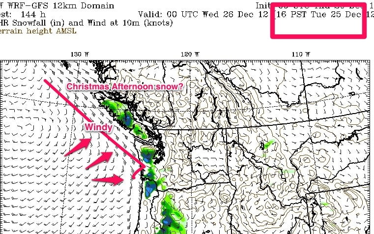
Now… On to the forecast for the coming week, and since we are within 5 days, CHRISTMAS. Note, the general natural of this should be accurate as its within 7 days, but the specific timing is still subject to change and indeed it could be wildly different. Saturday and Sunday will be the time we can start to get our hopes up, or not.
Now lets look at the models. Here is the full week… The trend stays cool and damp, but not so damp as to be a big warm pacific storm…
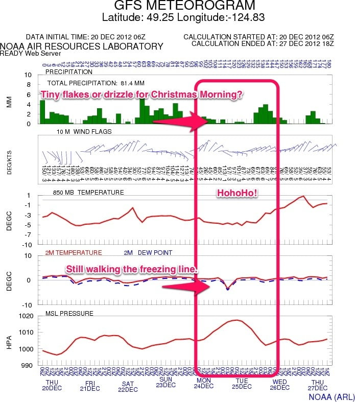
Here is today:
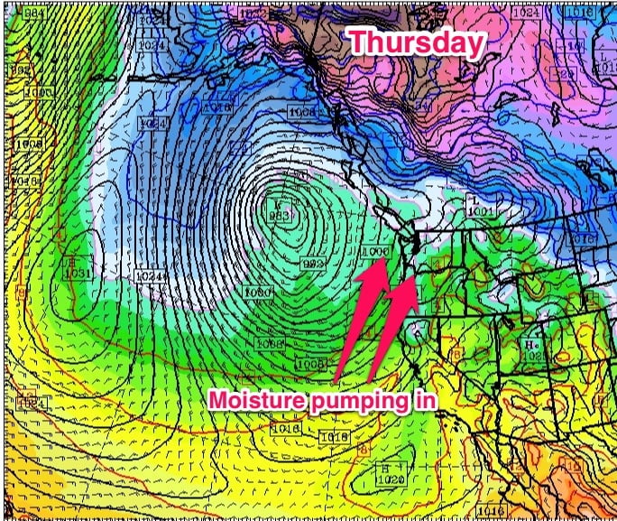
You can see the big low out there pumping precipitation up from the south. It’s going to spin out there for the next few days.
The low is forecast to finally approach the coast and die out on Monday, Christmas Eve.
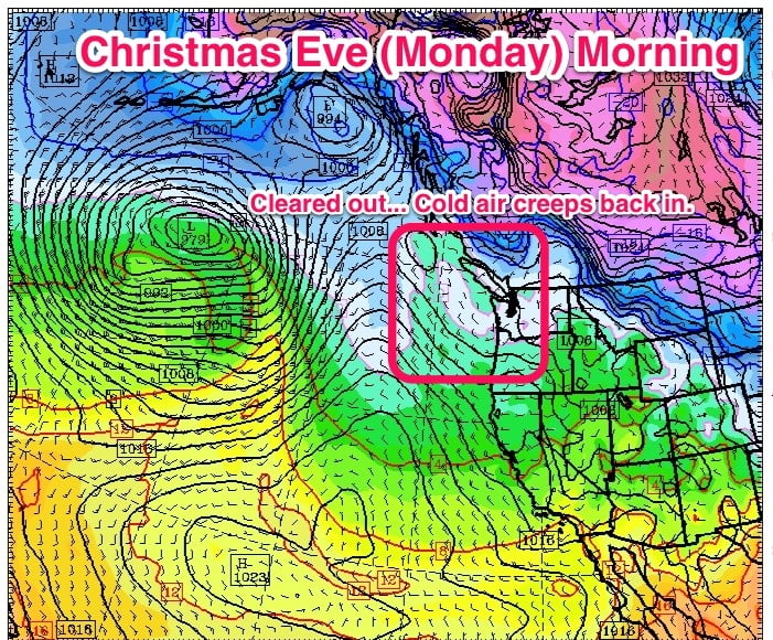
You can see the white and blues stretching onto Vancouver Island…. Just in time for Christmas Eve.
Here is the precipitation. As you can see. Dry. But lurking on the horizon…..
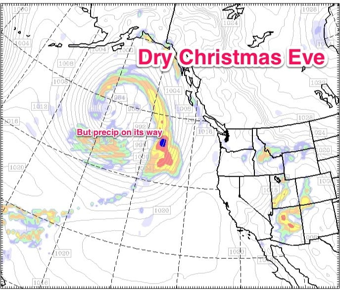
This is almost an exact repeat of yesterday’s setup with cold air trapped in the Valley and a Pacific front barreling in.
….. Again, the general idea should be accurate for this forecast, the timing may change though… The current low might break down sooner, or hang on more… The low predicted to swing a front our way might no be as strong… Lots of things can change, but at least at this point. There is hope. And isn’t that what Christmas is about?

