Special Statements likely to turn to Warnings
Environment Canada has release a Special Statement covering most of the South Coast warning of a series of storms lasting from today through Boxing Day. It is a long one, so I will only link it here.
Expect storms on Monday, Wednesday and Thursday with and possibly rain warnings issued.
Monday Stormy Night
Most of Monday should be calm during the day. The system will approach tonight and deliver rain overnight, starting around 10PM.
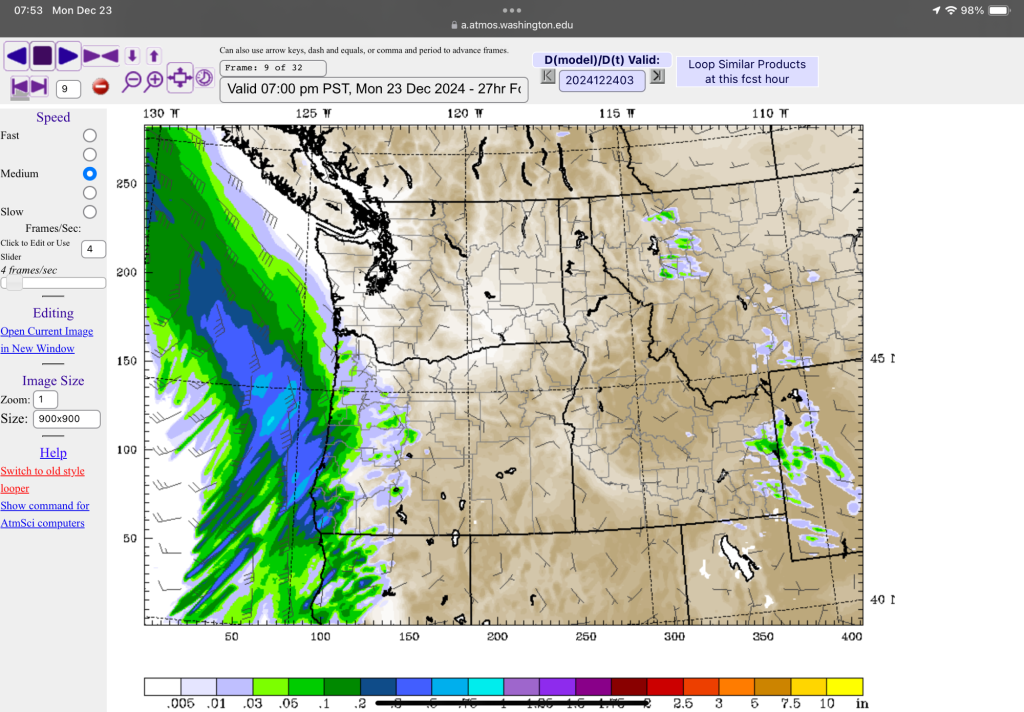
It will have gusty but not severe winds.
Tuesday Christmas Eve blustery day
We will get a blustery break from the rain with SW winds in the morning on Tuesday as a weaker section of rain passes down from the North.
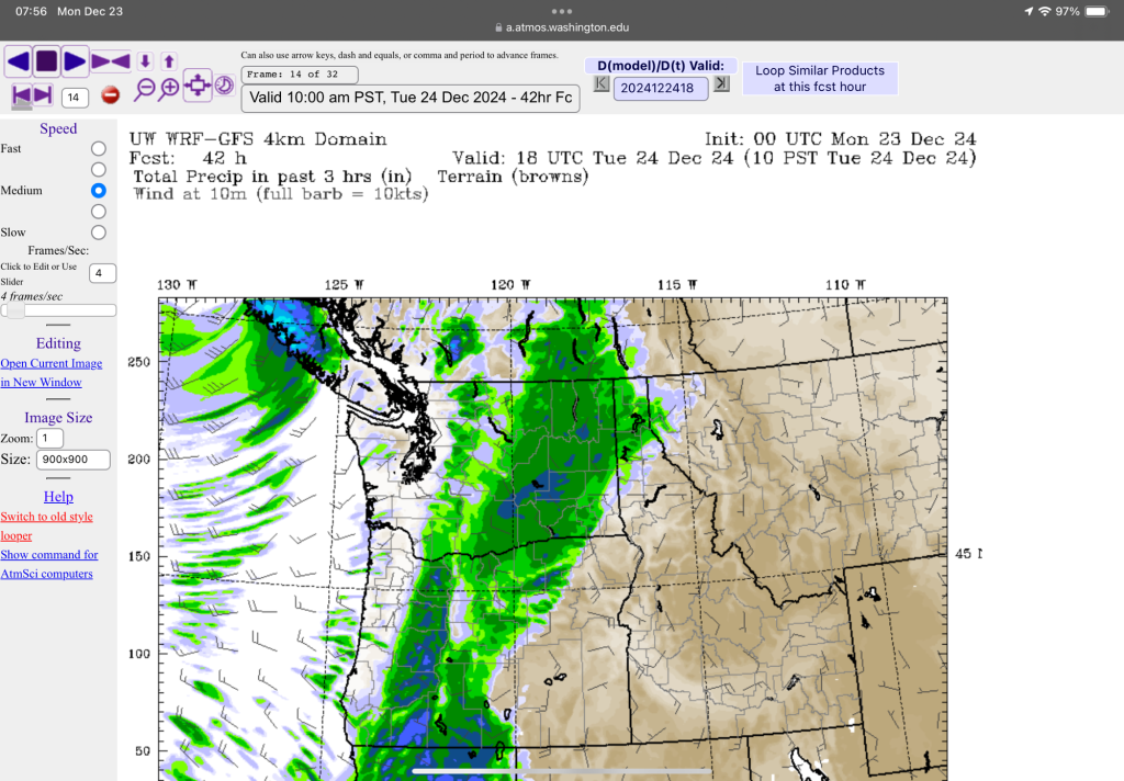
Expect rain on the mid island by noon and into the afternoon.
We should have scattered showers with some breezy conditions on Christmas Eve and overnight into Christmas Day, which is when the bigger storm comes in.
Christmas Day Storm
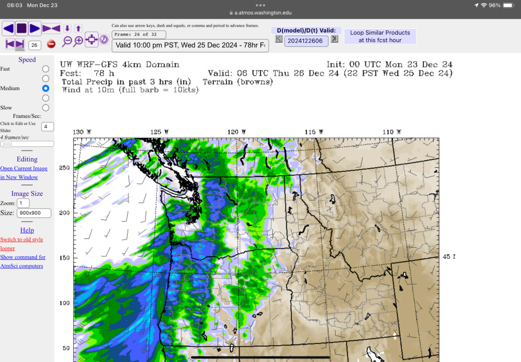
A major rain and wind storm impacts the entire Island starting Christmas morning. It’s a doozy.
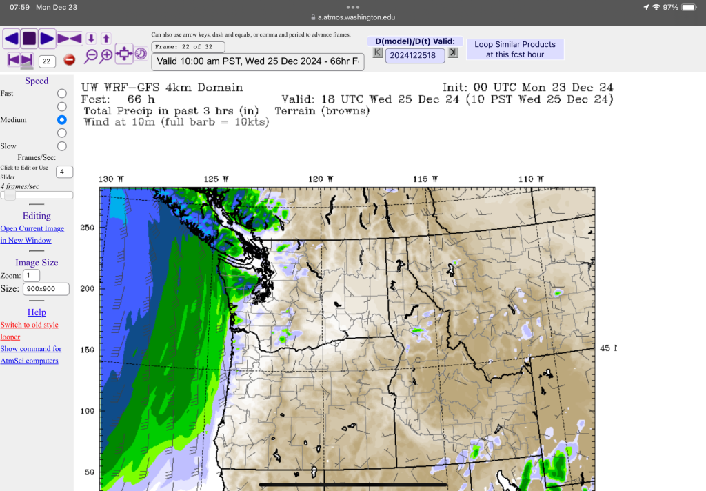
It has a ton of moisture with it and strong winds likely up to 90-100kph on the West Coast. EC is also predicting some storm surge from this event so combined with the seasonal high tides the ocean coastline will have higher water than normal.
Heavy rain and Southerly winds peak in the afternoon and evening.
You might want to get that turkey in the oven a little early! There will be a good chance for power outages in the afternoon and evening.
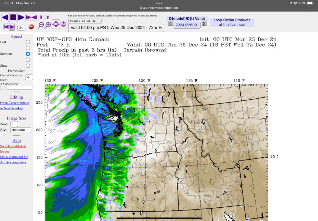
The good news is the system moves through reasonably quickly. The rain should stop and the winds die down before midnight on Christmas.
Boxing Day more rain and wind.
The party doesn’t stop at Christmas.
Yet another system will come in and deliver rain and strong winds on Boxing Day afternoon.
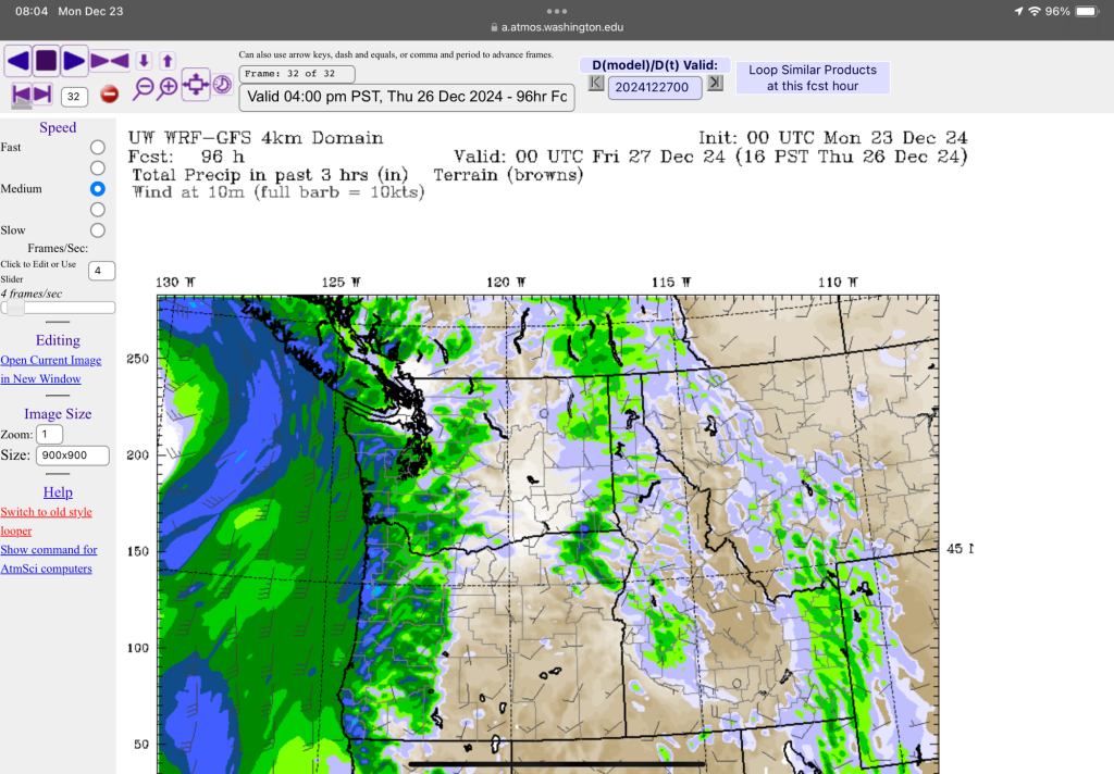
The rain should be a little less but the winds should be about the same as the previous storm the day before so there will be more opportunities for power outages and ferry cancellations.
This storm will last through the evening Thursday but clear by Friday morning.
Friday night final punch
One last weaker system will move in late Friday night and deliver rain and blustery but hopefully not severe winds.
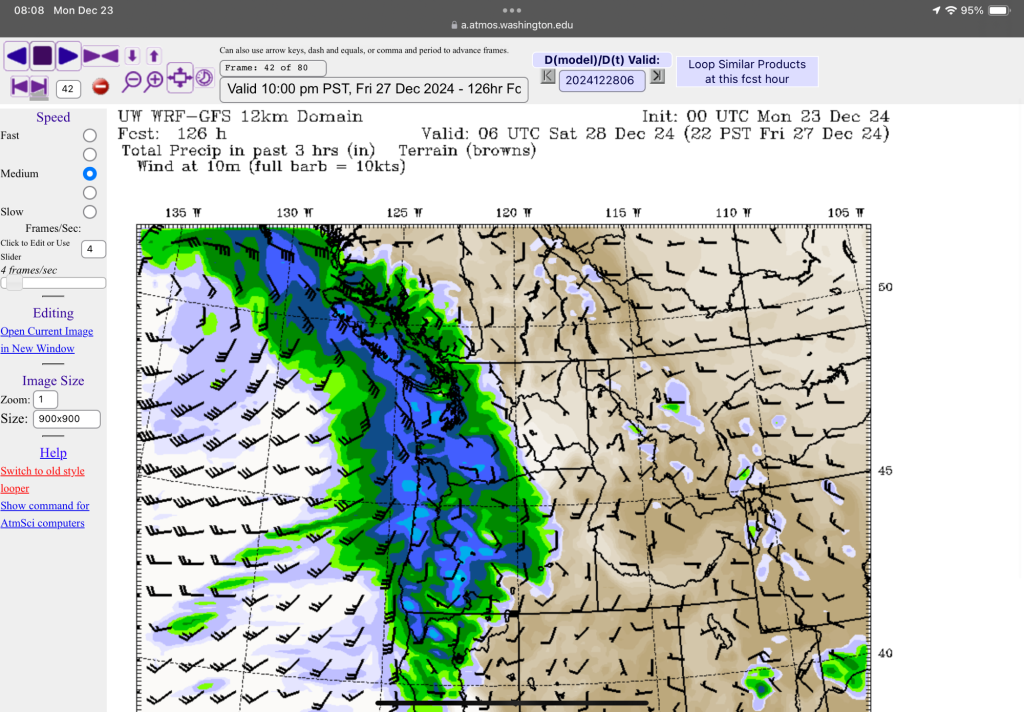
Another weaker system might roll in Saturday night next week but that will be the end of our parade of Christmas storms!
An eventful week!
Merry Christmas to all of you celebrating. Have a wonderful time with family and friends.


Leave a Reply
You must be logged in to post a comment.