The warm and sunny weather (minus the fog) should continue through most of the next week. There will be a few clouds this weekend, but no significant rainfall, if any at all. Temperatures will remain mild and above average for this year. Highs will be into the 20s until late next week if this forecast holds.
After next week there is a possibility for another major dump of rain, but it’s too far out to know for sure right now.
In other interesting weather related news:
#1: La Nina is picking up steam and is forecast to peak (which means mid-tropic-Pacific sea surface temperatures (SSTs) will be at their coolest) sometime in November/December
Great comparison here shows you the difference between an El Nino (which started last September)

and La Nina this September.

#2: La Nina generally brings us cool, dry winters on the West Coast… and a bunch of snow. The various winter forecasts I’ve seen out there all agree. There is potential for a snowy, and possibly very snowy winter here. Quite the contrast from last year.
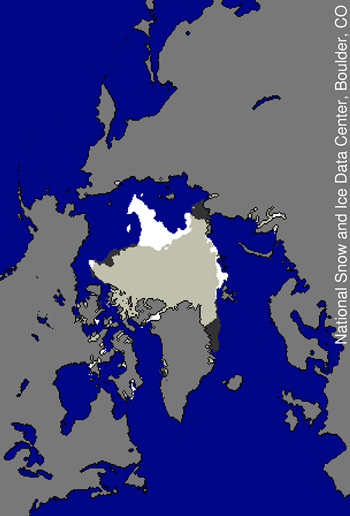
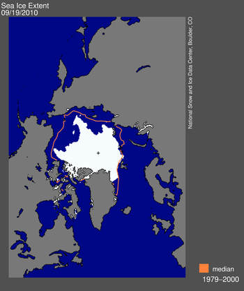
#3: Speaking of ice and snow. After making a bit of a rebound last year, the 2010 arctic ice melt season peaked last week with it’s third lowest coverage since satellite records began.
Below shows a comparison between 2010 and 2007, the year of record for least ice.
White areas is ice that stuck around this year compared to 2007, black are areas that were there in 2007 but not this year.

For the 3rd year in a row, the Northwest and NorthEast passage have been open and circumnavigation of the pole is possible. This has never happened in recorded history.

The real question now will be how thick is the ice up there. There has been a precipitous decline in overall sea ice thickness over the past decade, and this is what has allowed the ice to melt so fast in the summer. There will be new data coming on the state of the ice soon and I’ll post it here when it does.
