UPDATED I’ve received my telus router (the new one is quite nice actually!) and I believe everything is back up and running. Hooray!
…..
My continuing apologies for the data outage over the past week. Alberniweather has never been offline for this long. You can blame a faulty Telus DSL router and their nearest office in Burnaby for the delay. The kind person on the phone promised the replacement would be sent by Courier, and arrive in 3-5 days. Well, today is Day 4 so I’m hoping it will come.
……
Weather:
On the weather front, we are heading back to cloudier skies over the next couple days but at least it shouldn’t be too wet and it should warm again by Sunday and Monday.
Summer and the PDO:
I’ve been watching the summer forecasts and they seem to be slowly but steadily improving. We’ve gone from below normal temperatures and wet to a call for normal values.
I think the thing really holding us back from warmer times is what I have seen referred to as a ‘classic’ strong signature of a cold phase of the Pacific Decadal Oscillation. (PDO)
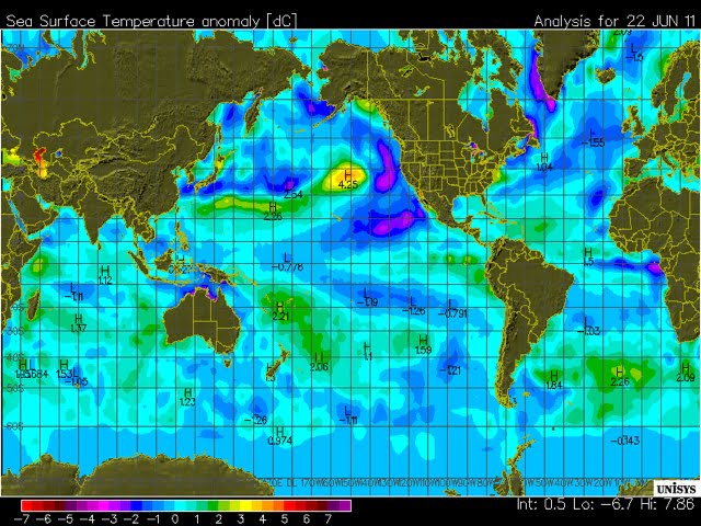
Here is the current Sea Surface Temperature anomaly chart. Purple being much below normal and red being above.
The classic signature is apparently that blob of very warm water above Hawaii right next to the very cold waters off of North America. Until those cold waters warm up, we should expect them to help cool our summer down some. But on the bright side this pattern does tend to enhance salmon and other native fisheries in our region.
You should also notice the tell tale signature of a fledgling El Nino extending warm waters off the tropical coast of South America. La Nina has officially ended but whether the trend grows into a full blown El Nino is still uncertain.
Global temperature trends:
And finally it’s worth mentioning that when
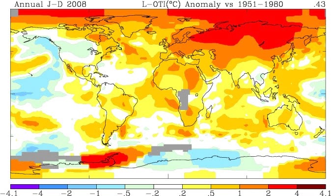
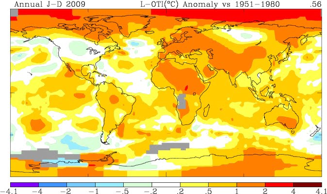
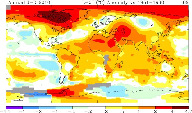
some meteorologists saw the PDO switching to a cold phase a couple years back they confidently declared that the days of record high global temperatures were coming to an end and we could even experience a cooling off period. Well, even though that has been true to an extent here in our part of the world, closest to the phenomenon, globally, not so much.
Data from the GISS here and elsewhere tell a very different story.
The following are the global temperature anomaly maps for 2008, 2009, 2010 and Spring 2011. The global overall anomaly temperature (between 0.43C and 0.62C) is at the top right of each. You will see it has continued to increase and even our very cool spring has not dampened the global average much.
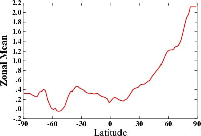
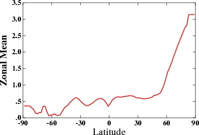
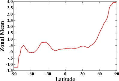
Even more shocking are these two graphs. They show the temperature anomalies based on latitude. -90 is the South Pole and +90 is the North Pole, look at the difference! No doubt this difference is due to the massive continent of Antarctica changing much more reluctantly than the open sea ice of the Arctic.
2008 Latitude differences
2C anomaly in 2008 and 3C in 2010… And below is for this spring, a 4C temperature anomaly in the Arctic. Stunning numbers.


Comments
2 responses to “UPDATED: Weather Data Back Online – Summer, the PDO, and you.”
Hey Chris…interesting read here: http://science.nasa.gov/science-news/science-at-nasa/2011/24jun_wildweather/
Thanks Taz cool read. Add another moniker to the list 🙂