Update 7:45PM
the majority of the City is back online. Still a bunch of smaller outages around the Valley though.
are you ready for a potential round two on Saturday?
Update 5:45PM
BCHydro has restored some power but big swath of port alberni city and valley eta now not on until 10PM.
Update 4:50PM
BC Hydro now says 6:30PM back on.
Update 4:30PM
Big Power Outage!
Alberniweather HQ is out too so no updates for weather info. Check www.bchydro.com for updates. Current on time is 9PM. Hopefully.
Update 9:17AM:
BC Ferries has cancelled the 8:30 and 10:30 sailings both directions between Horseshoe Bay and Departure Bay due to wind.
— NanaimoNewsNOW.com (@NanaimoNewsNOW) December 10, 2015
Update: New Low Barometer Record for This Station.
We just dropped through 97.88kPa/978.8mb which breaks the record for December for this alberniweather station of 97.98kPa set during the big windstorms, December 14, 2006. The barometer continues to drop as the low approaches. All time station low for alberniweather was set in January 2008 at 96.58mb. We will not get there as the low is ‘only’ around 96.8kPa.
I’ve been active on Twitter mainly this morning so I’ll include those in this post. You can follow me directly @Alberniweather.
The barometer reading should be your first clue that there is plenty of wind out there. It has not been too strong in Port Alberni, but Nanaimo and the East Coast has been quite strong and there has been a top gust of 110kph at Trial Island off Victoria.
https://twitter.com/alberniweather/status/674944073648574464
That was at 5:30AM. The barometer is still falling. It is now 979.5mb. We might break a record for December at my station.
https://twitter.com/alberniweather/status/674945910762135554
Again, this was at 5:30AM this morning. It is now 974mb.
https://twitter.com/alberniweather/status/674947352013107200
This buoy is now rising and at 968mb. So the low has passed this location.
Strong gradient and some destabilization now will get a contribution from the pressure-change component. Windy #YVR! pic.twitter.com/hyYIev1BtB
— Chris Doyle (@ensembleator) December 10, 2015
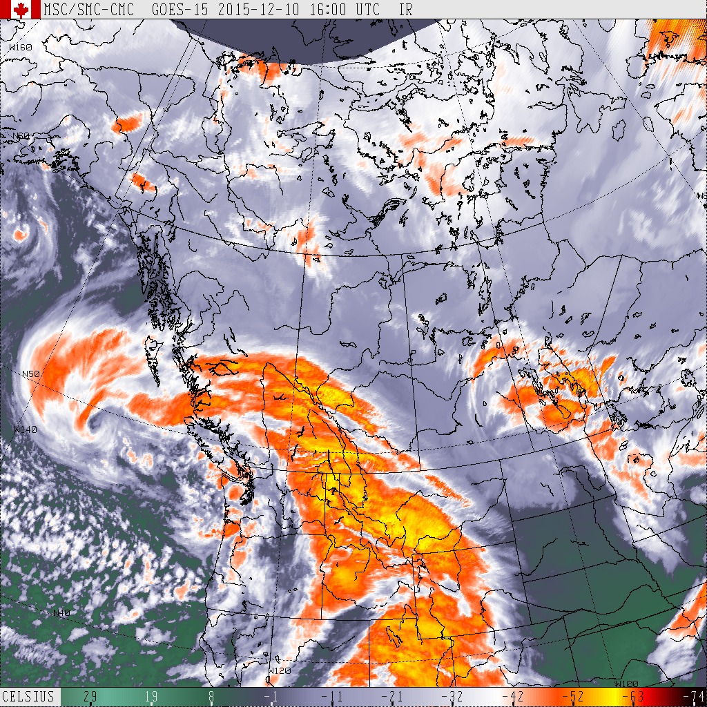
Above was the approximate location at 5:41AM. The current location can be estimated by looking at the Satellite picture for the swirl.
Looks like it is currently roughly due West of Port Alberni.
The wind is continuing and will likely continue for a few more hours, especially on the East side.
It seems to have come from a strange direction earlier this morning… see my stream of tweets just now. Be safe on the roads.
https://twitter.com/alberniweather/status/674978436675338242
https://twitter.com/alberniweather/status/674978848623038464
https://twitter.com/alberniweather/status/674979596744286208
https://twitter.com/alberniweather/status/674980183670022144
https://twitter.com/alberniweather/status/674981347434217472
The current buffer is only about 20 metres. It should be more like 100 metres in my opinion. And in the case of Cathedral Grove, those trees have stood the test of time (a measly 200+ years or more) because they were protected in the bottom of the grove. The more clear cutting there is in the Cameron River Valley, the more exposed the Grove is, and the more likely for there to be trees coming down.
I’ll keep an eye on the storm the rest of the day. There is still another coming on Saturday and it might just drag down enough cold air for snow too!


